
File:British bechuanaland 1887.jpg

Size of this preview: 606 × 600 pixels. Other resolutions: 243 × 240 pixels | 485 × 480 pixels | 776 × 768 pixels | 1,035 × 1,024 pixels | 1,644 × 1,627 pixels.
Original file (1,644 × 1,627 pixels, file size: 181 KB, MIME type: image/jpeg)
| This is a file from the Wikimedia Commons. Information from its description page there is shown below. Commons is a freely licensed media file repository. You can help. |
Summary
| Description |
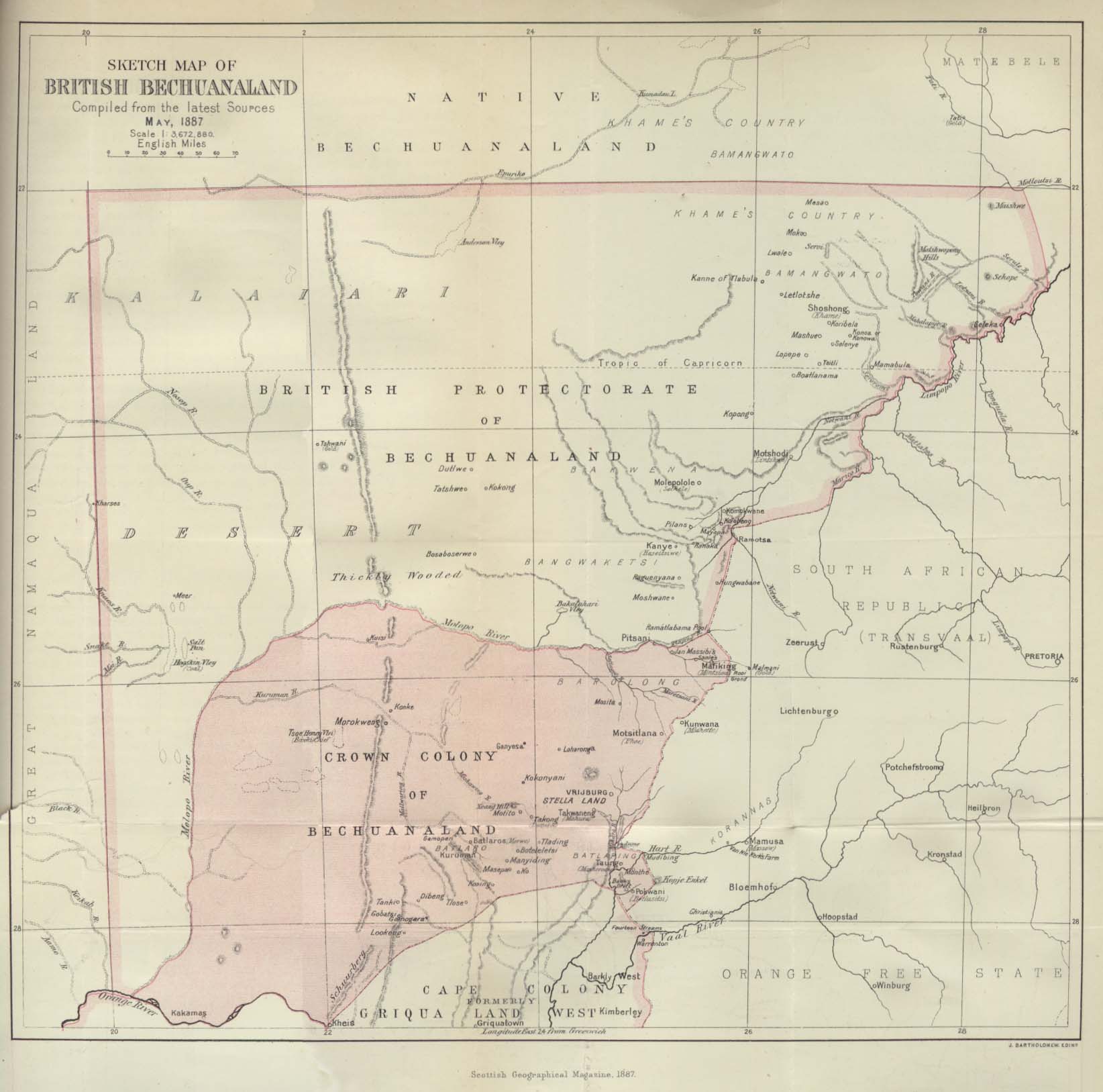
Deutsch: Karte von Betschuanaland, Mai 1887.
English: Sketch Map of British Bechuanaland, May 1887. |
| Date | |
| Source |
The Scottish Geographical Magazine. Published by the Scottish Geographical Society and edited by Arthur Silva White. Volume III, 1887. |
| Author | John George Bartholomew |
Licensing
|
This work is in the public domain in its country of origin and other countries and areas where the copyright term is the author's life plus 70 years or fewer. | |
| This file has been identified as being free of known restrictions under copyright law, including all related and neighboring rights. | |
File history
Click on a date/time to view the file as it appeared at that time.
| Date/Time | Thumbnail | Dimensions | User | Comment | |
|---|---|---|---|---|---|
| current | 21:09, 24 August 2005 | | 1,644 × 1,627 (181 KB) | Atamari | British bechuanaland (1887) {{PD-old}} * source from http://www.lib.utexas.edu/maps/historical/british_bechuanaland_1887.jpg * "Sketch Map of British Bechuanaland, May 1887" from the Scottish Geographical Magazine. Published by the Scottish Geographical |
File usage
The following 3 pages use this file:
Global file usage
The following other wikis use this file:
- Usage on af.wikipedia.org
- Usage on ast.wikipedia.org
- Usage on ca.wikipedia.org
- Usage on da.wikipedia.org
- Usage on de.wikipedia.org
- Usage on eo.wikipedia.org
- Usage on es.wikipedia.org
- Usage on et.wikipedia.org
- Usage on fr.wikipedia.org
- Usage on id.wikipedia.org
- Usage on it.wikipedia.org
- Usage on ja.wikipedia.org
- Usage on no.wikipedia.org
- Usage on pl.wikipedia.org
- Usage on pt.wikipedia.org
- Usage on pt.wikibooks.org
- Usage on ru.wikipedia.org
- Usage on sv.wikipedia.org
- Usage on uk.wikipedia.org
- Usage on www.wikidata.org
- Usage on wuu.wikipedia.org
- Usage on zh.wikipedia.org