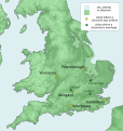
File:British Isles 10th century.svg
Appearance

Size of this PNG preview of this SVG file: 378 × 599 pixels. Other resolutions: 151 × 240 pixels | 303 × 480 pixels | 484 × 768 pixels | 646 × 1,024 pixels | 1,292 × 2,048 pixels | 990 × 1,569 pixels.
Original file (SVG file, nominally 990 × 1,569 pixels, file size: 1.78 MB)
File history
Click on a date/time to view the file as it appeared at that time.
| Date/Time | Thumbnail | Dimensions | User | Comment | |
|---|---|---|---|---|---|
| current | 00:13, 13 July 2018 |  | 990 × 1,569 (1.78 MB) | Kashmiri | Corrected location of London and Kingston (relative to Thames) |
| 20:40, 4 September 2013 |  | 990 × 1,569 (1.78 MB) | Ikonact | file size optimisation | |
| 21:00, 2 September 2013 |  | 990 × 1,569 (4.31 MB) | Ikonact | now with old coastline | |
| 14:40, 1 September 2013 |  | 990 × 1,569 (2.55 MB) | Ikonact | some names in grey to improve visibility | |
| 20:57, 31 August 2013 |  | 990 × 1,569 (2.54 MB) | Ikonact | updates of the places, rivers names | |
| 17:57, 31 August 2013 |  | 990 × 1,569 (2.53 MB) | Ikonact | User created page with UploadWizard |
File usage
The following 8 pages use this file:
Global file usage
The following other wikis use this file:
- Usage on az.wikipedia.org
- Usage on el.wikipedia.org
- Usage on hu.wikipedia.org
- Usage on it.wikipedia.org
- Usage on ja.wikipedia.org
- Usage on no.wikipedia.org
- Usage on ru.wikipedia.org
- Usage on simple.wikipedia.org
- Usage on th.wikipedia.org
- Usage on www.wikidata.org


