
File:Bourke County 1866.jpg
Size of this preview: 744 × 599 pixels. Other resolutions: 298 × 240 pixels | 596 × 480 pixels | 953 × 768 pixels | 1,271 × 1,024 pixels | 2,412 × 1,943 pixels.
Original file (2,412 × 1,943 pixels, file size: 738 KB, MIME type: image/jpeg)
| This is a file from the Wikimedia Commons. Information from its description page there is shown below. Commons is a freely licensed media file repository. You can help. |
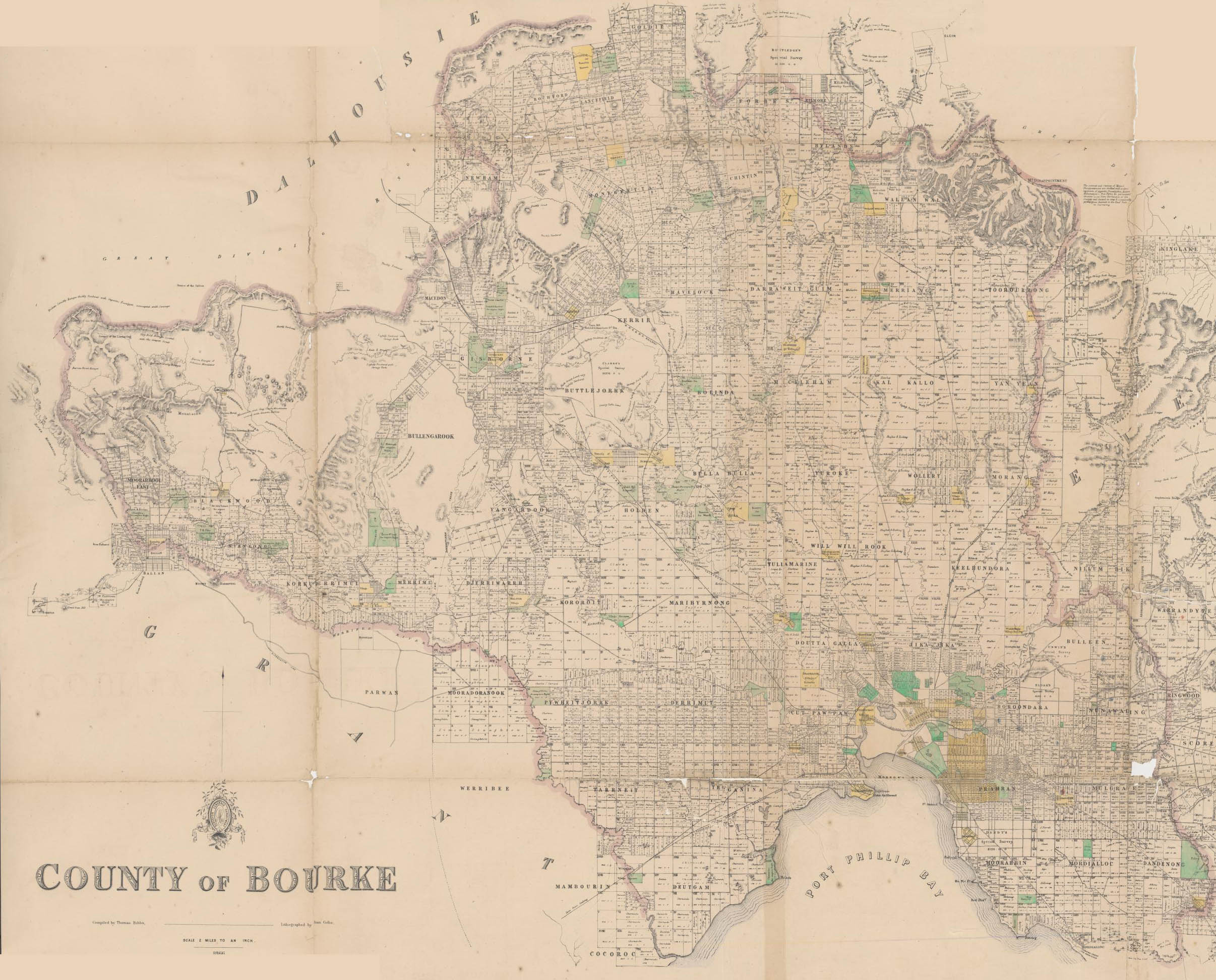
Map of Bourke County in 1866 from the National Library located here.
Title: County of Bourke [cartographic material] / compiled by Thomas Bibbs ; lithographed by William Collis ; Surveyor General's Department.
This image or other work is of Australian origin and is now in the public domain because its term of copyright has expired. According to the Australian Copyright Council (ACC), ACC Information Sheet G023v19 (Duration of copyright) (January 2019).1
When using this template, please provide information of where the image was first published and who created it. |
 | |||||||||||||||||||
File history
Click on a date/time to view the file as it appeared at that time.
| Date/Time | Thumbnail | Dimensions | User | Comment | |
|---|---|---|---|---|---|
| current | 10:29, 10 March 2007 | | 2,412 × 1,943 (738 KB) | Roke~commonswiki | Map of Bourke County in 1866 from the National Library located [http://nla.gov.au/nla.map-rm1009 here]. Title: County of Bourke [cartographic material] / compiled by Thomas Bibbs ; lithographed by William Collis ; Surveyor General's Department. [[Categ |
File usage
The following 3 pages use this file: