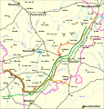
File:Border-Lithuania-Poland-1919-1939.svg
Appearance

Size of this PNG preview of this SVG file: 568 × 600 pixels. Other resolutions: 227 × 240 pixels | 455 × 480 pixels | 728 × 768 pixels | 970 × 1,024 pixels | 1,940 × 2,048 pixels | 1,476 × 1,558 pixels.
Original file (SVG file, nominally 1,476 × 1,558 pixels, file size: 641 KB)
File history
Click on a date/time to view the file as it appeared at that time.
| Date/Time | Thumbnail | Dimensions | User | Comment | |
|---|---|---|---|---|---|
| current | 23:50, 8 March 2009 |  | 1,476 × 1,558 (641 KB) | Masur | Augustów and Suwałki - corrected localizations (swapped). |
| 07:09, 28 August 2008 |  | 1,476 × 1,558 (668 KB) | Renata3 | new improved version | |
| 18:48, 27 December 2005 |  | 575 × 463 (113 KB) | Knutux | Borders between Lithuania and Poland in 1919-1939 Legend to follow Category:Historical maps of Lithuania |
File usage
The following 13 pages use this file:
- 1919 Polish coup attempt in Lithuania
- Foch Line
- History of Lithuania
- History of Vilnius
- Lithuania–Poland border
- Lithuania–Poland relations
- Polish–Lithuanian War
- Republic of Central Lithuania
- Sejny Uprising
- Suwałki Agreement
- User:Artemis Andromeda/sandbox/Republic of Lithuania (1918–1940)
- User:Falcaorib/Poland-Lithuania
- Portal:Lithuania
Global file usage
The following other wikis use this file:
- Usage on ar.wikipedia.org
- Usage on be-tarask.wikipedia.org
- Usage on be.wikipedia.org
- Usage on bn.wikipedia.org
- Usage on ca.wikipedia.org
- Usage on cs.wikipedia.org
- Usage on de.wikipedia.org
- Usage on el.wikipedia.org
- Usage on es.wikipedia.org
- Usage on et.wikipedia.org
- Usage on fi.wikipedia.org
- Usage on fr.wikipedia.org
- Usage on he.wikipedia.org
- Usage on hr.wikipedia.org
- Usage on hu.wikipedia.org
- Usage on it.wikipedia.org
- Usage on ja.wikipedia.org
- Usage on lt.wikipedia.org
View more global usage of this file.

