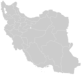
File:Blank-Map-Iran.PNG
Appearance

Size of this preview: 652 × 600 pixels. Other resolutions: 261 × 240 pixels | 522 × 480 pixels | 895 × 823 pixels.
Original file (895 × 823 pixels, file size: 22 KB, MIME type: image/png)
File history
Click on a date/time to view the file as it appeared at that time.
| Date/Time | Thumbnail | Dimensions | User | Comment | |
|---|---|---|---|---|---|
| current | 00:34, 24 June 2013 |  | 895 × 823 (22 KB) | BasilLeaf | بروزرسانی مرزها |
| 12:39, 12 November 2010 |  | 895 × 823 (36 KB) | M samadi | Alborz Province added, Border of South & Razavi Khorasans updated. | |
| 00:34, 28 July 2007 |  | 895 × 823 (39 KB) | Siamax | {{Information |Description=Blank Map of Iran |Source=self-made applying some corrections and updates to a previous version Image:BlankMap-Iran.PNG created and uploaded by Shinas |Date=27th July 2007 |Author= Siamax }} |
File usage
The following page uses this file:
