File:Bastille in Medieval Paris Map..png
Appearance
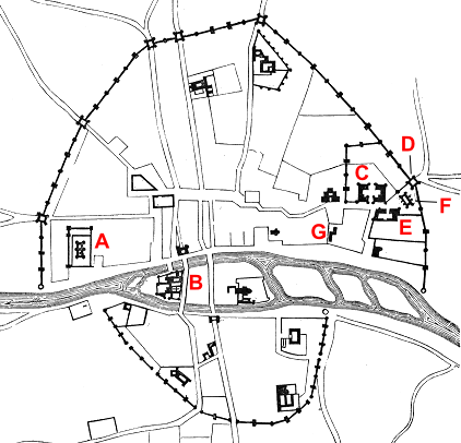
Bastille_in_Medieval_Paris_Map..png (422 × 406 pixels, file size: 98 KB, MIME type: image/png)
File history
Click on a date/time to view the file as it appeared at that time.
| Date/Time | Thumbnail | Dimensions | User | Comment | |
|---|---|---|---|---|---|
| current | 19:29, 23 August 2011 |  | 422 × 406 (98 KB) | Hchc2009 | Labelling in red |
| 16:06, 15 August 2011 |  | 422 × 406 (98 KB) | Hchc2009 | {{Information |Description=Map of Paris in 14th century |Source=*File:Plan.Paris.XIVe.siecle.2.png |Date=2011-08-15 16:03 (UTC) |Author=*File:Plan.Paris.XIVe.siecle.2.png: Viiolet le Duc *derivative work: ~~~ |Permission= |other_versions= }} |
File usage
The following page uses this file:
Global file usage
The following other wikis use this file:
- Usage on br.wikipedia.org
- Usage on es.wikipedia.org
- Usage on ms.wikipedia.org

