
File:Bahnstrecke Wörth–Strasbourg.png

Size of this preview: 711 × 600 pixels. Other resolutions: 285 × 240 pixels | 569 × 480 pixels | 910 × 768 pixels | 1,214 × 1,024 pixels | 2,427 × 2,048 pixels | 4,888 × 4,124 pixels.
Original file (4,888 × 4,124 pixels, file size: 9.39 MB, MIME type: image/png)
| This is a file from the Wikimedia Commons. Information from its description page there is shown below. Commons is a freely licensed media file repository. You can help. |
Summary
| Description |
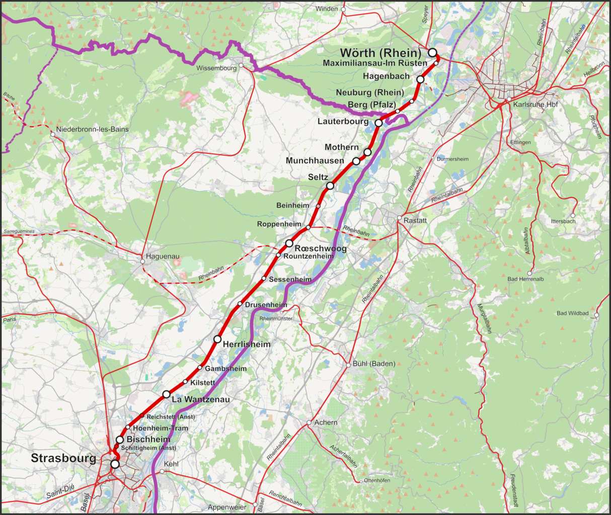
English: Map of the Worth–Strasbourg railway going from Rhineland-Palatinate, Germany to Alsace, France
Deutsch: Karte der Bahnstrecke Wörth–Strasbourg in Rheinland-Pfalz, Deutschland und Elsass, Frankreich
Français : Carte de la Ligne de Strasbourg à Lauterbourg
Nederlands: Kaart Spoorlijn Straatsburg - Lauterbourg
Polski: Mapa Linia kolejowa Strasbourg – Wörth am Rhein |
| Date | |
| Source |
Own work Map was created using: |
| Author | |
| Permission (Reusing this file) |
Map data (c) OpenStreetMap (and) contributors, CC-BY-SA |
Licensing
This file is licensed under the Creative Commons Attribution-Share Alike 2.0 Generic license.
- You are free:
- to share – to copy, distribute and transmit the work
- to remix – to adapt the work
- Under the following conditions:
- attribution – You must give appropriate credit, provide a link to the license, and indicate if changes were made. You may do so in any reasonable manner, but not in any way that suggests the licensor endorses you or your use.
- share alike – If you remix, transform, or build upon the material, you must distribute your contributions under the same or compatible license as the original.
File history
Click on a date/time to view the file as it appeared at that time.
| Date/Time | Thumbnail | Dimensions | User | Comment | |
|---|---|---|---|---|---|
| current | 12:42, 4 June 2022 | | 4,888 × 4,124 (9.39 MB) | Pechristener | verlorene Zwischenstationen wieder eingesetzt |
| 13:40, 29 May 2022 |  | 4,888 × 4,124 (9.31 MB) | Pechristener | fixed according to disc | |
| 21:45, 3 June 2014 |  | 3,128 × 2,640 (2.63 MB) | Pechristener | == {{int:filedesc}} == {{Information |Description ={{en|1=Map of the Worth–Strsbourg railway going from Rhineland-Palatinate, Germany to Alsace, France}} {{de|1=Karte der Bahnstrecke Wörth–Strasbourg in R... |
File usage
The following page uses this file:
Global file usage
The following other wikis use this file:
- Usage on de.wikipedia.org
- Usage on fr.wikipedia.org
- Usage on ja.wikipedia.org
- Usage on www.wikidata.org
- Usage on zh.wikipedia.org