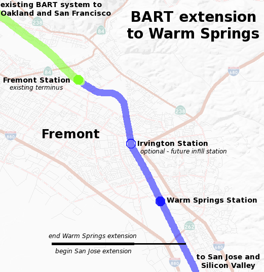
File:BART-WS-extension-map.png
Appearance
BART-WS-extension-map.png (521 × 537 pixels, file size: 85 KB, MIME type: image/png)
File history
Click on a date/time to view the file as it appeared at that time.
| Date/Time | Thumbnail | Dimensions | User | Comment | |
|---|---|---|---|---|---|
| current | 21:42, 2 January 2017 |  | 521 × 537 (85 KB) | Jeanjung212 | Lossless Compressed/optimized png decreasing file size by 48050 bytes |
| 00:52, 14 December 2008 |  | 521 × 537 (132 KB) | Ikluft | major cleanup - add mid-background layer with highways and highway shields | |
| 11:19, 7 December 2008 |  | 521 × 537 (180 KB) | Ikluft | {{Information |Description={{en|1=Map of the planned Bay Area Rapid Transit extension to Warm Springs. The background map of Fremont was generated by the [http://www.nationalmap.gov/ USGS National Map]. The route and plans are |
File usage
The following 3 pages use this file:
Global file usage
The following other wikis use this file:
- Usage on nl.wikipedia.org


