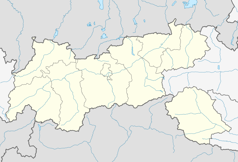
File:Austria Tyrol location map.svg
Appearance

Size of this PNG preview of this SVG file: 800 × 546 pixels. Other resolutions: 320 × 218 pixels | 640 × 437 pixels | 1,024 × 699 pixels | 1,280 × 873 pixels | 2,560 × 1,746 pixels | 1,504 × 1,026 pixels.
Original file (SVG file, nominally 1,504 × 1,026 pixels, file size: 2.05 MB)
File history
Click on a date/time to view the file as it appeared at that time.
| Date/Time | Thumbnail | Dimensions | User | Comment | |
|---|---|---|---|---|---|
| current | 19:01, 27 November 2013 |  | 1,504 × 1,026 (2.05 MB) | NordNordWest | c |
| 22:53, 26 November 2013 |  | 1,504 × 1,026 (2.04 MB) | NordNordWest | == {{int:filedesc}} == {{Information |Description= {{de|Positionskarte von Tirol, Österreich}} Quadratische Plattkarte. Geographische Begrenzung der Karte: * N: 47.9037638° N * S: 46.5040638° N * W: 10.0237916° O *... |
File usage
The following 34 pages use this file:
- 2017–18 Austrian Regionalliga
- 2018 UCI Road World Championships
- 2018–19 Austrian Regionalliga
- Arzl im Pitztal
- Austrian Regionalliga West
- Berneck Castle
- Hall in Tirol
- Innsbruck
- Ischgl
- Jochberg, Tyrol
- Kitzbühel
- Landesliga Ost (Tyrol)
- Landesliga West (Tyrol)
- Lienz
- Mutters
- Oetz
- Olympiaregion Seefeld
- Pinswang
- Prägraten am Großvenediger
- Regionalliga Tirol
- Reutte
- Sankt Leonhard im Pitztal
- Schwaz
- Sillian
- Spiss
- St. Johann in Tirol
- Sölden
- Tannheim, Tyrol
- Tiroler Liga
- Wenns
- Zams
- User:Spitzmauskc/St. Johann
- Module:Location map/data/Austria Tyrol
- Module:Location map/data/Austria Tyrol/doc
Global file usage
The following other wikis use this file:
- Usage on als.wikipedia.org
- Usage on an.wikipedia.org
- Usage on ar.wikipedia.org
- Usage on az.wikipedia.org
- Usage on bg.wikipedia.org
- Usage on cv.wikipedia.org
- Usage on de.wikipedia.org
- Alpenzoo Innsbruck
- Stephansbrücke (Brennerstraße)
- Tivoli Stadion Tirol
- MARTHA-Dörfer
- Tischofer Höhle
- Europabrücke (Brenner Autobahn)
- Flughafen Innsbruck
- Pontlatzer Brücke
- Großglockner Resort Kals–Matrei
- Wildbichler Brücke
- Hundalm-Eishöhle
- Hintertuxer Gletscher
- Tivoli-Stadion (Innsbruck)
- Olympiahalle Innsbruck
- Hohe Brücke (St. Georgenberg)
- Flugplatz Kufstein-Langkampfen
- Kajetansbrücke
- Flugplatz Lienz-Nikolsdorf
- Wikipedia:Kartenwerkstatt/Positionskarten/Europa
- Dolomitenstadion
- Vorlage:Positionskarte Österreich Tirol
- Diskussion:Zugspitze/Archiv
- Bezirkskrankenhaus Lienz
- Olympia Eiskanal Igls
- Kaufhaus Tyrol
- Cyta Shoppingwelt
- Landeskrankenhaus Innsbruck
- Aqua Dome
- Zettersfeld
- Raritätenzoo Ebbs
- Flugplatz St. Johann in Tirol
- Sillpark
- Österreichische Fußballmeisterschaft 2012/13
- Tiroler Wasserkraft Arena Innsbruck
- Hängebrücke Holzgau
- Mittelpunkt Tirols
- Österreichische Fußballmeisterschaft 2013/14
- Bahnhof Patsch
- Highline179
- Österreichische Fußballmeisterschaft 2015/16
- Pitztalbrücke
View more global usage of this file.


