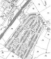
File:Austin Village OS map 1936 1 2500 25 inch.jpg
Appearance

Size of this preview: 522 × 599 pixels. Other resolutions: 209 × 240 pixels | 418 × 480 pixels | 669 × 768 pixels | 892 × 1,024 pixels | 1,783 × 2,048 pixels | 3,720 × 4,272 pixels.
Original file (3,720 × 4,272 pixels, file size: 4.01 MB, MIME type: image/jpeg)
File history
Click on a date/time to view the file as it appeared at that time.
| Date/Time | Thumbnail | Dimensions | User | Comment | |
|---|---|---|---|---|---|
| current | 14:01, 8 May 2009 |  | 3,720 × 4,272 (4.01 MB) | Oosoom | {{Information |Description=Old OS map of Category:Austin Village between Northfield and Longbridge, Birmingham, England. Retouched to remove paper joins. |Source=Ordn |
File usage
The following 2 pages use this file:
Global file usage
The following other wikis use this file:
- Usage on ga.wikipedia.org
- Usage on ig.wikipedia.org
- Usage on ja.wikipedia.org
- Usage on www.wikidata.org

