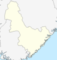
File:Aust-Agder2.png
Appearance
Aust-Agder2.png (551 × 581 pixels, file size: 13 KB, MIME type: image/png)
File history
Click on a date/time to view the file as it appeared at that time.
| Date/Time | Thumbnail | Dimensions | User | Comment | |
|---|---|---|---|---|---|
| current | 07:34, 14 February 2011 |  | 551 × 581 (13 KB) | Jon Harald Søby | glemte kystfargen |
| 07:21, 14 February 2011 |  | 551 × 581 (13 KB) | Jon Harald Søby | same colours as the standard location maps | |
| 22:08, 23 May 2008 |  | 551 × 581 (13 KB) | Frokor | {{Information |Description=Map of Aust-Agder, used in locator map templates. |Source=http://www.maps-for-free.com/ |Date=24 May 2008 |Author=Modified by Frokor |Permission=http://www.maps-for-free.com/html/about.html |other_versions= }} == |
File usage
No pages on the English Wikipedia use this file (pages on other projects are not listed).
Global file usage
The following other wikis use this file:
- Usage on de.wikipedia.org
- Usage on fa.wikipedia.org
- Usage on fi.wikipedia.org
- Usage on he.wikipedia.org
- Usage on nn.wikipedia.org
- Mal:Kartposisjon Aust-Agder
- Jomfruland fyrstasjon
- Strømtangen fyrstasjon i Kragerø
- Stavseng fyrstasjon
- Lyngør fyrstasjon
- Stangholmen fyrstasjon
- Ytre Møkkalasset fyrstasjon
- Store Torungen fyrstasjon
- Lille Torungen fyrstasjon
- Sandvikodden fyrstasjon
- Rivingen fyrstasjon
- Homborsund fyrstasjon
- Saltholmen fyrstasjon
- Hylestad stavkyrkje


