Jump to content

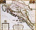
File:Atlas Van der Hagen- IlIyricvm Sclavoniam- Bosnam Dalmatiam Slavoniam Croatiam.jpg

Page contents not supported in other languages.
This is a file from the Wikimedia Commons
From Wikipedia, the free encyclopedia

Original file (5,353 × 4,520 pixels, file size: 8.09 MB, MIME type: image/jpeg)

Summary

ILIYRICVM HODIERNVM, Quod Scriptores communiter SCLAVONIAM, Itali SCHIAVONIAM nuncupare solent, in Dalmatiam, Croatiam, Bosnam, et Slavoniam   (Wikidata search (Cirrus search) Wikidata query (SPARQL)  Create new Wikidata item based on this file)
Author
Publisher:
Joan Blaeu  (1596–1673)  wikidata:Q379677
 
Joan Blaeu
Alternative names
Johannes Blaeu; John Wiliamson Blaeu; Johannes Willemszoon Blaeu
Description Dutch cartographer, publisher, instrument maker and book printer
Date of birth/death 23 September 1596 Edit this at Wikidata 28 December 1673 Edit this at Wikidata
Location of birth/death Alkmaar Edit this at Wikidata Amsterdam Edit this at Wikidata
Work period 1615 Edit this at Wikidata–1673 Edit this at Wikidata
Work location
Amsterdam; Vienna; Amsterdam (1631–1662) Edit this at Wikidata
Authority file
creator QS:P170,Q379677
Title
ILIYRICVM HODIERNVM, Quod Scriptores communiter SCLAVONIAM, Itali SCHIAVONIAM nuncupare solent, in Dalmatiam, Croatiam, Bosnam, et Slavoniam
Object type map
object_type QS:P31,Q4006
Description
Nederlands: Deze kaart van de oostkust van de Adriatische Zee werd in 1663 door Joan Blaeu (1598-1673) gepubliceerd in de franse editie van zijn Atlas Maior. Waarschijnlijk kopieerde Blaeu de afbeelding uit een moderne Franse bron, wat niet betekende dat het kaartbeeld daarmee ook actueel was. Door de Turkse bezetting gedurende de 17de eeuw was het gebied nauwelijks toegankelijk waardoor kartografen veelvuldig gebruik maakten van verouderd kaartmateriaal uit de 16de eeuw.; Middenonder een opdracht van Joan Blaeu aan de graaf Perpetuo de Zrin.
English: This map of the eastern coast of the Adriatic Sea was published in 1663 by Joan Blaeu (1598-1673) in the french edition of his Atlas Maior. Blaeu probable copied the image from a contemporary French source, which did not garantee the maps actuality. Because of the Turkish occupation in the 17th century the area was hardly accessible. For that reason cartographers often had to rely on older materials from the 16th century.
Date 1663
date QS:P571,+1663-00-00T00:00:00Z/9
Medium
Nederlands: kopergravure
Dimensions 44 x 52 cm
institution QS:P195,Q1526131
Accession number
Description of the Atlas Van der Hagen in the catalogue of the KB: http://opc4.kb.nl/DB=1/TTL=1/LNG=EN/PPN?PPN=353012750
Place of creation Amsterdam
Notes KW1049B12_084 - Volume 1
Related persons
InfoField
Joan Blaeu - Perpetuo de Zrin, graaf
Depicted locations
InfoField
Adriatic Sea - Croatia - Dalmatia - Bosnia-Hercegovina
Source/Photographer

Source page at the Geheugen van Nederland / Memory of the Netherlands website.

Permission
(Reusing this file)
This is a faithful photographic reproduction of a two-dimensional, public domain work of art. The work of art itself is in the public domain for the following reason:
Public domain

This work is in the public domain in its country of origin and other countries and areas where the copyright term is the author's life plus 100 years or fewer.


You must also include a United States public domain tag to indicate why this work is in the public domain in the United States.
This file has been identified as being free of known restrictions under copyright law, including all related and neighboring rights.
The official position taken by the Wikimedia Foundation is that "faithful reproductions of two-dimensional public domain works of art are public domain".
This photographic reproduction is therefore also considered to be in the public domain in the United States. In other jurisdictions, re-use of this content may be restricted; see Reuse of PD-Art photographs for details.
Public domain
This work is in the public domain in the United States because it was published (or registered with the U.S. Copyright Office) before January 1, 1929.

Public domain works must be out of copyright in both the United States and in the source country of the work in order to be hosted on the Commons. If the work is not a U.S. work, the file must have an additional copyright tag indicating the copyright status in the source country.
Note: This tag should not be used for sound recordings.PD-1923Public domain in the United States//commons.wikimedia.org/wiki/File:Atlas_Van_der_Hagen-_IlIyricvm_Sclavoniam-_Bosnam_Dalmatiam_Slavoniam_Croatiam.jpg
Other versions
image extraction process
This file has been extracted from another file
: Atlas Van der Hagen-KW1049B12 084-ILLYRICVM HODIERNVM, Quod Scriptores communiter SCLAVONIAM, Itali SCHIAVONIAM nuncupare solent, in Dalmatiam, Croatiam, Bosnam, et Slavoniam.jpg
original file

Captions

Add a one-line explanation of what this file represents

image/jpeg

446fcee0a4dbf1aacae609e57e0c4dbf8af3214d

8,486,393 byte

4,520 pixel

5,353 pixel

File history

Click on a date/time to view the file as it appeared at that time.

Date/TimeThumbnailDimensionsUserComment
current03:42, 23 January 2022Thumbnail for version as of 03:42, 23 January 20225,353 × 4,520 (8.09 MB)Santasa99

Global file usage

The following other wikis use this file:

Metadata