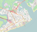
File:Atlantic City, New Jersey - OpenStreetMap.png
Appearance

Size of this preview: 695 × 600 pixels. Other resolutions: 278 × 240 pixels | 556 × 480 pixels | 890 × 768 pixels | 1,075 × 928 pixels.
Original file (1,075 × 928 pixels, file size: 575 KB, MIME type: image/png)
File history
Click on a date/time to view the file as it appeared at that time.
| Date/Time | Thumbnail | Dimensions | User | Comment | |
|---|---|---|---|---|---|
| current | 15:33, 2 August 2016 |  | 1,075 × 928 (575 KB) | Tagishsimon | {{OpenStreetMap | name = Atlantic_City_NJ | location = Atlantic_City_NJ | description = Map of Atlantic City, New Jersey. | top = 39.3873 | bottom = 39.3498 | left = -74.4566 | right = -74.4004 |... |
File usage
The following 8 pages use this file:
Global file usage
The following other wikis use this file:
- Usage on ar.wikipedia.org
- Usage on zh.wikipedia.org

