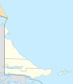
File:Argentina Tierra del Fuego and Staten Island location map.svg
Appearance

Size of this PNG preview of this SVG file: 528 × 600 pixels. Other resolutions: 211 × 240 pixels | 422 × 480 pixels | 676 × 768 pixels | 901 × 1,024 pixels | 1,802 × 2,048 pixels | 624 × 709 pixels.
Original file (SVG file, nominally 624 × 709 pixels, file size: 569 KB)
File history
Click on a date/time to view the file as it appeared at that time.
| Date/Time | Thumbnail | Dimensions | User | Comment | |
|---|---|---|---|---|---|
| current | 19:38, 3 May 2020 |  | 624 × 709 (569 KB) | Janitoalevic | Improved |
| 00:18, 30 December 2017 |  | 449 × 373 (317 KB) | Milenioscuro | +Tolhuin department | |
| 15:02, 14 July 2013 |  | 449 × 373 (405 KB) | Milenioscuro | == {{int:filedesc}} == {{Information |Description={{de|Positionskarte von Mendoza (Argentinien)}}{{en|Location map of Mendoza province (Argentina)}}{{es|1=Mapa de localización de la Provincia de Mendoza.}} Equirec... |
File usage
The following 3 pages use this file:
Global file usage
The following other wikis use this file:
- Usage on de.wikipedia.org
- Usage on es.wikipedia.org
- Ushuaia
- Aeropuerto Internacional Malvinas Argentinas
- Tolhuin
- Lago Escondido (Tierra del Fuego)
- Río Grande (Tierra del Fuego)
- Puerto Parry
- Puerto Almanza
- Wikiproyecto:Ilustración/Taller de Cartografía/Realizaciones/América del Sur
- Plantilla:Mapa de localización de Tierra del Fuego (Argentina) e Isla de los Estados
- Puerto Cook
- Isla de los Lobos (Río Grande)
- San Sebastián (Tierra del Fuego)
- Sarmiento (Tierra del Fuego)
- Puerto Golondrina
- Estación Macarena
- Estación Parque Nacional
- Estación del Fin del Mundo
- Bahía Thetis (localidad)
- Aeródromo de Tolhuin
- Terminal Cuestas del Monte Susana
- Usage on frr.wikipedia.org
- Usage on id.wikipedia.org
- Usage on ja.wikipedia.org
- Usage on kbd.wikipedia.org
- Usage on ko.wikipedia.org
- Usage on ml.wikipedia.org
- Usage on pl.wikipedia.org
- Fagnano
- Ushuaia
- Cieśnina Le Maire’a
- Park Narodowy Ziemi Ognistej
- Río Grande (Ziemia Ognista)
- Port lotniczy Ushuaia
- Wyspa Stanów
- Port lotniczy Río Grande
- Szablon:Państwo dane Ziemia Ognista
- Tolhuin
- Yehuin
- Cerro Castor
- Moduł:Mapa/dane/Ziemia Ognista
- Moduł:Mapa/dane/AR-V
- Latarnia morska Les Eclaireurs
- Latarnia morska San Juan de Salvamento
- Observatorio (wyspa w Argentynie)
View more global usage of this file.

