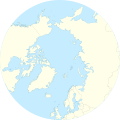
File:Arctic Ocean relief location map.png
Appearance

Size of this preview: 600 × 600 pixels. Other resolutions: 240 × 240 pixels | 480 × 480 pixels | 768 × 768 pixels | 1,181 × 1,181 pixels.
Original file (1,181 × 1,181 pixels, file size: 2.19 MB, MIME type: image/png)
File history
Click on a date/time to view the file as it appeared at that time.
| Date/Time | Thumbnail | Dimensions | User | Comment | |
|---|---|---|---|---|---|
| current | 08:49, 24 December 2010 |  | 1,181 × 1,181 (2.19 MB) | Uwe Dedering | {{Information |Description={{en|1= Relief location map of the Arctic Ocean. * Projection: Azimuthal equidistant projection. * Area of interest: :* N: 90.0° N :* S: 50.0° N :* W: -180.0° E :* E: 180.0° E * Projection center: :* NS: 90° N :* WE: 0° E |
File usage
The following 41 pages use this file:
- 83-42
- ATOW1996
- Bohlinryggen
- East Siberian Sea
- Greenland Plain
- Hovtinden
- Ilulissat
- Iversenfjellet
- Jan Mayensfield
- Kara Sea
- Keilhaufjellet
- Kursk submarine disaster
- Lake North Pole
- Lincoln Sea
- Litke Deep
- Mars habitability analogue environments on Earth
- Molloy Deep
- Ostra Bramatoppen
- Pechora Sea
- Prince Gustaf Adolf Sea
- Puppebu
- Queen Victoria Sea
- Systemafjellet
- White Sea
- York Mountains
- User:Dino/sandbox
- User:Fraenir/Draft4
- User:Ty654/List of earthquakes from 1920-1929 exceeding magnitude 6+
- User:Ty654/List of earthquakes from 1950-1954 exceeding magnitude 6+
- User:Ty654/List of earthquakes from 1955-1959 exceeding magnitude 6+
- User:Ty654/List of earthquakes from 1965-1969 exceeding magnitude 6+
- User:Ty654/List of earthquakes from 1970-1974 exceeding magnitude 6+
- User:Ty654/List of earthquakes from 1975-1979 exceeding magnitude 6+
- User:Ty654/List of earthquakes from 1985-1989 exceeding magnitude 6+
- User:Ty654/List of earthquakes from 1990-1994 exceeding magnitude 6+
- User:Ty654/List of earthquakes from 1995-1999 exceeding magnitude 6+
- User:Ty654/List of earthquakes from 2000-2004 exceeding magnitude 6+
- User:Ty654/List of earthquakes from 2005-2009 exceeding magnitude 6+
- User:Ty654/List of earthquakes from 2010-2014 exceeding magnitude 6+
- Module:Location map/data/Arctic
- Module:Location map/data/Arctic/doc
Global file usage
The following other wikis use this file:
- Usage on ar.wikipedia.org
- Usage on ast.wikipedia.org
- Usage on az.wikipedia.org
- Usage on ban.wikipedia.org
- Usage on be-tarask.wikipedia.org
- Usage on ceb.wikipedia.org
- Usage on ce.wikipedia.org
- Usage on cs.wikipedia.org
- Usage on de.wikipedia.org
- Usage on dsb.wikipedia.org
- Usage on eo.wikipedia.org
- Bafina Golfo
- Janmajeno
- Halvmåneøya
- Lando de Francisko Jozefo
- Rudolf-insulo
- Lando Georgo
- Vilĉek-lando
- Insulo Northbrook
- Disko-insulo
- Devon (insulo)
- Banks-insulo
- Ŝablono:Situo sur mapo Arkta oceano
- Kotelnij
- Insulo Ellesmere
- Insulo Reĝo Vilhelmo
- Viktoria Insulo (Kanado)
- Golfo Amundsen (Arkto)
- Nordaustlandet
- Usage on es.wikipedia.org
View more global usage of this file.


