
File:Ant-pen-map-Kiev.PNG
Size of this preview: 436 × 599 pixels. Other resolutions: 175 × 240 pixels | 349 × 480 pixels | 720 × 989 pixels.
Original file (720 × 989 pixels, file size: 256 KB, MIME type: image/png)
| This is a file from the Wikimedia Commons. Information from its description page there is shown below. Commons is a freely licensed media file repository. You can help. |
Summary
| Description |
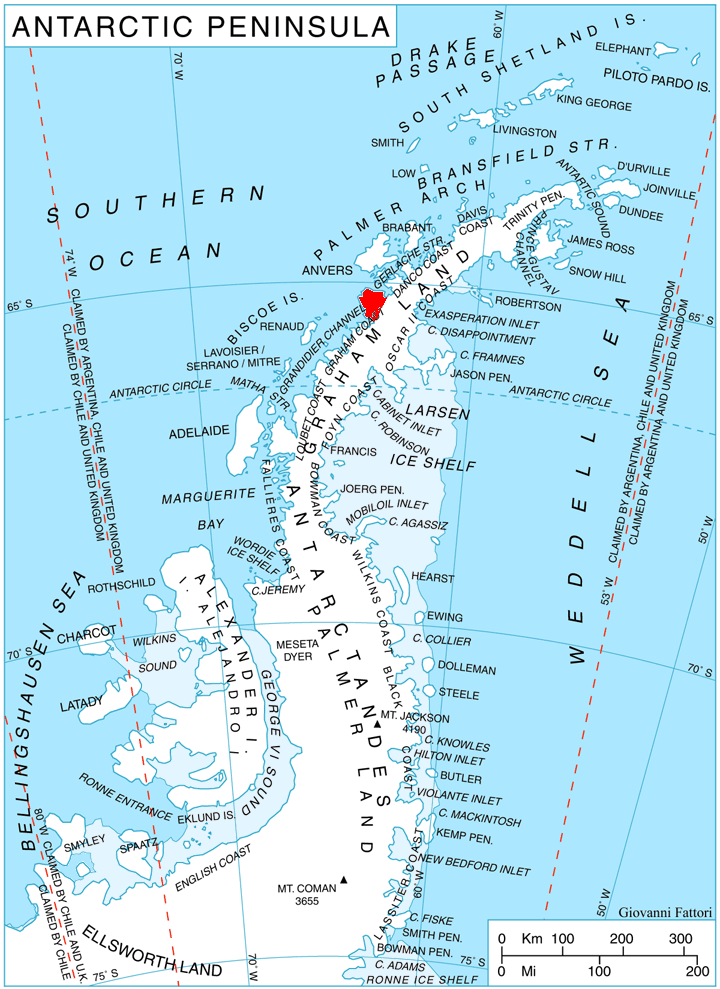
English: Location of Kiev Peninsula, Antarctica. |
| Date | |
| Source | Own work, using map File:Ant-pen map.png by Giovanni Fattori. |
| Author | Edited by Apcbg |
Licensing
I, the copyright holder of this work, hereby publish it under the following licenses:
This file is licensed under the Creative Commons Attribution-Share Alike 3.0 Unported license.
- You are free:
- to share – to copy, distribute and transmit the work
- to remix – to adapt the work
- Under the following conditions:
- attribution – You must give appropriate credit, provide a link to the license, and indicate if changes were made. You may do so in any reasonable manner, but not in any way that suggests the licensor endorses you or your use.
- share alike – If you remix, transform, or build upon the material, you must distribute your contributions under the same or compatible license as the original.

|
Permission is granted to copy, distribute and/or modify this document under the terms of the GNU Free Documentation License, Version 1.2 or any later version published by the Free Software Foundation; with no Invariant Sections, no Front-Cover Texts, and no Back-Cover Texts. A copy of the license is included in the section entitled GNU Free Documentation License. |
You may select the license of your choice.
File history
Click on a date/time to view the file as it appeared at that time.
| Date/Time | Thumbnail | Dimensions | User | Comment | |
|---|---|---|---|---|---|
| current | 06:50, 4 September 2013 | | 720 × 989 (256 KB) | Apcbg | Better quality. |
| 15:26, 1 November 2010 |  | 720 × 989 (256 KB) | Apcbg | == Summary == {{Information |Description={{en|1=Location of Kiev Peninsula, Antarctica.}} |Source={{own}}, using map File:Ant-pen map.png by Giovanni Fattori. |Author=Edited by Apcbg |Date=2010-11-01 |Permission= |other_versions= }} [ |
File usage
The following 32 pages use this file:
- Bachstrom Point
- Belgica Glacier
- Blanchard Ridge
- Bussey Glacier
- Cape Cloos
- Cape Pérez
- Cape Tuxen
- Deloncle Bay
- False Cape Renard
- Girard Bay
- Glandaz Point
- Hotine Glacier
- Humphries Heights
- Kyiv Peninsula
- Leay Glacier
- Lemaire Channel
- Lind Glacier
- Loubat Point
- Mount Balch
- Mount Boland
- Mount Cloos
- Mount Demaria
- Mount Matin
- Mount Nygren
- Mount Peary
- Mount Scott (Antarctica)
- Mount Shackleton
- Régnard Peaks
- Somers Glacier
- Trooz Glacier
- Valiente Peak
- Wiggins Glacier
Global file usage
The following other wikis use this file:
- Usage on de.wikipedia.org
- Usage on fr.wikipedia.org
- Usage on gv.wikipedia.org
- Usage on he.wikipedia.org
- Usage on it.wikipedia.org
- Usage on ja.wikipedia.org
- Usage on nl.wikipedia.org
- Usage on nn.wikipedia.org
- Usage on pt.wikipedia.org
- Usage on ru.wikipedia.org
- Usage on uk.wikipedia.org
- Usage on www.wikidata.org
- Usage on zh.wikipedia.org
View more global usage of this file.