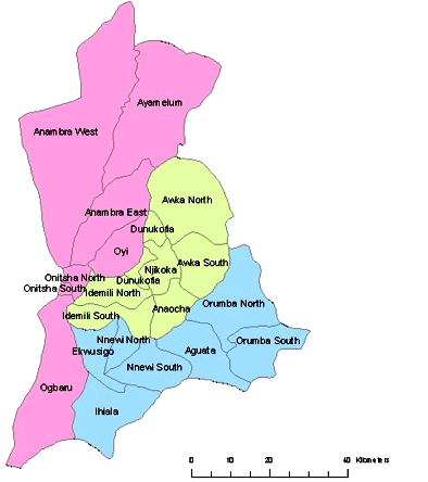
File:Anambra lga map.gif
Appearance
Anambra_lga_map.gif (394 × 444 pixels, file size: 36 KB, MIME type: image/gif)
File history
Click on a date/time to view the file as it appeared at that time.
| Date/Time | Thumbnail | Dimensions | User | Comment | |
|---|---|---|---|---|---|
| current | 11:10, 10 September 2012 |  | 394 × 444 (36 KB) | McZusatz | crop |
| 13:12, 8 January 2010 |  | 401 × 450 (37 KB) | Nwabu2010 | Colored | |
| 12:36, 8 January 2010 |  | 250 × 372 (28 KB) | Nwabu2010 | {{Information |Description={{en|1=Anambra State Map of Local Government Areas (LGA)}} |Source={{own}} |Author=Nwabu2010 |Date=2003-01-01 |Permission= |other_versions= }} Category:Anambra Category:Nigeria |
File usage
The following 2 pages use this file:
Global file usage
The following other wikis use this file:
- Usage on ca.wikipedia.org
- Usage on fr.wikipedia.org
- Usage on ha.wikipedia.org
- Usage on hy.wikipedia.org
- Usage on igl.wikipedia.org
- Usage on ja.wikipedia.org
- Usage on ka.wikipedia.org
- Usage on ku.wikipedia.org
- Usage on ru.wikipedia.org
- Usage on si.wikipedia.org
- Usage on uk.wikipedia.org

