
File:AltaiUrianhaiJutgeltGunHoshuu.jpg
Size of this preview: 747 × 600 pixels. Other resolutions: 299 × 240 pixels | 598 × 480 pixels | 956 × 768 pixels | 1,275 × 1,024 pixels | 2,550 × 2,048 pixels | 3,824 × 3,071 pixels.
Original file (3,824 × 3,071 pixels, file size: 8.44 MB, MIME type: image/jpeg)
| This is a file from the Wikimedia Commons. Information from its description page there is shown below. Commons is a freely licensed media file repository. You can help. |
Summary
| Description |
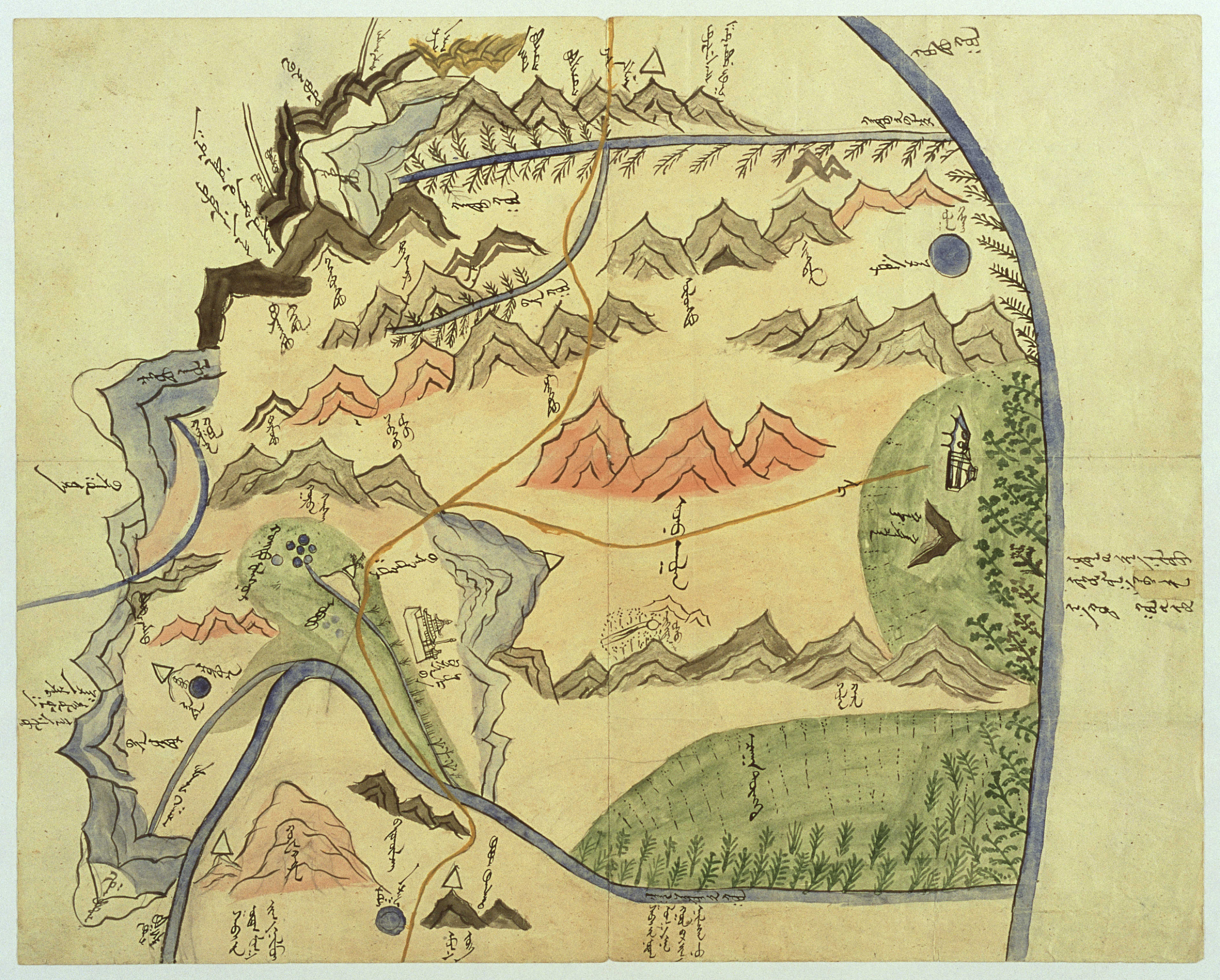
English: Map of the Jütgelt Gün's hoshuu (banner) of the Altai Urianhai in western Mongolia. Material is Chinese paper, original size is 36x45 cm. See also Kamimura's article, p. 10. |
| Date | between 1912 and 1914 |
| Source | Akira Kamimura: Old Mongolian Manuscript Maps |
| Author | Unknown author |
Licensing
|
This is a faithful photographic reproduction of a two-dimensional, public domain work of art. The work of art itself is in the public domain for the following reason:
The official position taken by the Wikimedia Foundation is that "faithful reproductions of two-dimensional public domain works of art are public domain".
This photographic reproduction is therefore also considered to be in the public domain in the United States. In other jurisdictions, re-use of this content may be restricted; see Reuse of PD-Art photographs for details. |
File history
Click on a date/time to view the file as it appeared at that time.
| Date/Time | Thumbnail | Dimensions | User | Comment | |
|---|---|---|---|---|---|
| current | 13:29, 12 September 2008 | | 3,824 × 3,071 (8.44 MB) | Yaan | {{Information |Description={{en|1=Map of the Jütgelt Gün's hoshuu (banner) of the Altai Urianhai in western Mongolia. Material is Chinese paper, original size is 36x45 cm. See also [http://mongol.tufs.ac.jp/landmaps/docs/Kamimura_article.pdf Kamimura's |
File usage
The following 2 pages use this file:
Global file usage
The following other wikis use this file:
- Usage on de.wikipedia.org
- Usage on fr.wikipedia.org
- Usage on id.wikipedia.org
- Usage on ko.wikipedia.org
- Usage on mn.wikipedia.org
- Usage on sl.wikipedia.org
- Usage on sr.wikipedia.org
- Usage on zh.wikipedia.org