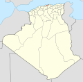
File:Algeria 35 Wilaya locator map-2009.svg
Appearance

Size of this PNG preview of this SVG file: 508 × 500 pixels. Other resolutions: 244 × 240 pixels | 488 × 480 pixels | 780 × 768 pixels | 1,040 × 1,024 pixels | 2,081 × 2,048 pixels.
Original file (SVG file, nominally 508 × 500 pixels, file size: 70 KB)
File history
Click on a date/time to view the file as it appeared at that time.
| Date/Time | Thumbnail | Dimensions | User | Comment | |
|---|---|---|---|---|---|
| current | 17:53, 19 November 2009 |  | 508 × 500 (70 KB) | Sting | {{Information |Description={{en|Locator map of the Boumerdès Province, Algeria, as in 2009.}} {{fr|Carte de localisation de la Wilaya de Boumerdès, Algérie, telle |
File usage
The following 18 pages use this file:
- 2005 Tidjelabine bombing
- 2006 Boudouaou bombing
- 2006 Tidjelabine bombing
- 2007 Souk El Had bombing
- 2008 Beni Amrane bombings
- 2008 Issers bombing
- 2008 Naciria bombing
- 2008 Thénia bombing
- 2008 Zemmouri bombing
- 2010 Bordj Menaïel bombing
- 2010 Tidjelabine bombing
- 2012 Baghlia bombing
- 2012 Thénia bombing
- August 2010 Baghlia bombing
- Bordj Menaïel District
- Isser District
- Khemis El Khechna District
- Naciria District
Global file usage
The following other wikis use this file:
- Usage on ar.wikipedia.org
- Usage on be.wikipedia.org
- Usage on fa.wikipedia.org
- Usage on hi.wikipedia.org
- Usage on id.wikipedia.org
- Usage on is.wikipedia.org
- Usage on pt.wikipedia.org
- Usage on ru.wikipedia.org
- Usage on simple.wikipedia.org
- Usage on sr.wikipedia.org
- Usage on sw.wikipedia.org
- Usage on uk.wikipedia.org
- Usage on zh.wikipedia.org

