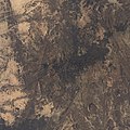
File:Ahaggar Landsat 8 pan sharpened composite.jpg
Appearance

Size of this preview: 600 × 600 pixels. Other resolutions: 240 × 240 pixels | 480 × 480 pixels | 768 × 768 pixels | 1,024 × 1,024 pixels | 2,048 × 2,048 pixels | 8,751 × 8,751 pixels.
Original file (8,751 × 8,751 pixels, file size: 24.49 MB, MIME type: image/jpeg)
File history
Click on a date/time to view the file as it appeared at that time.
| Date/Time | Thumbnail | Dimensions | User | Comment | |
|---|---|---|---|---|---|
| current | 17:40, 19 March 2021 |  | 8,751 × 8,751 (24.49 MB) | Linus Wolf | increase number of input rasters to 58 |
| 04:03, 21 December 2020 |  | 8,751 × 8,751 (24.49 MB) | Linus Wolf | increased number of input rasters to 54 | |
| 12:18, 4 August 2020 |  | 8,751 × 8,751 (24.37 MB) | Linus Wolf | increased number of input images to 49 while excluding a few; fixed a problem causing artefacts | |
| 22:39, 13 July 2020 |  | 8,721 × 8,721 (24.04 MB) | Linus Wolf | + 1 input raster; undid histogram matching (while fixing an error in weighted averaging), switched back to intensity-hue-saturation method for panchromatic sharpening, and changed scaling so that channels are not scaled separately | |
| 16:35, 13 April 2020 |  | 8,693 × 8,693 (25.35 MB) | Linus Wolf | discarded one more input raster with clouds, added several which seem good in the extent used for this image. Switched to Brovey reweighting for panchromatic sharpening. Added histogram matching between input rasters (the change in color is noticeable, I think). Fixed an issue of missing values not being excluded in averaging. | |
| 18:25, 24 December 2019 |  | 8,675 × 8,675 (23.67 MB) | Linus Wolf | added one new input raster; removed one which had clouds; set gamma correction to power 1.3 | |
| 00:47, 5 October 2019 |  | 8,654 × 8,654 (23.47 MB) | Linus Wolf | + 1 input raster | |
| 01:34, 12 May 2019 |  | 8,610 × 8,610 (23.09 MB) | Linus Wolf | + 1 input raster; slight gamma correction | |
| 01:16, 14 April 2019 |  | 8,482 × 8,482 (22.35 MB) | Linus Wolf | {{Information |description ={{en|1=The Ahaggar, also known as the Hoggar, a volcanic mountain range in the central Sahara. The image is averaged from 32 Landsat 8-scenes, provided by NASA. Bands 4, 3, 2 and 8 were combined into an RGB image. Co-registration, weighted averaging, and rescaling to extrema of the scenes was done in R with the package [https://bleutner.github.io/RStoolbox/ RStoolbox]. JPEG-encoded with [https://github.... |
File usage
The following page uses this file:
Global file usage
The following other wikis use this file:
- Usage on ceb.wikipedia.org
- Usage on cs.wikipedia.org
- Usage on de.wikipedia.org
- Usage on fa.wikipedia.org
- Usage on fr.wikipedia.org
- Usage on nl.wikipedia.org
- Usage on sv.wikipedia.org
- Usage on www.wikidata.org


