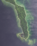
File:Aerial view of southeastern Detroit Island, Door County, Wisconsin 2020.png
Appearance

Size of this preview: 431 × 599 pixels. Other resolutions: 173 × 240 pixels | 345 × 480 pixels | 552 × 768 pixels | 736 × 1,024 pixels | 1,473 × 2,048 pixels | 9,118 × 12,675 pixels.
Original file (9,118 × 12,675 pixels, file size: 240.3 MB, MIME type: image/png)
File history
Click on a date/time to view the file as it appeared at that time.
| Date/Time | Thumbnail | Dimensions | User | Comment | |
|---|---|---|---|---|---|
| current | 15:49, 31 January 2022 |  | 9,118 × 12,675 (240.3 MB) | Epiphyllumlover | c:User:Rillke/bigChunkedUpload.js: {{Information | Description = {{en|Aerial view of southeastern Detroit Island in Door County, Wisconsin, taken July 28, 2020. Coordinates: *Center Latitude 45°16'53.40"N *Center Longitude 86°54'21.53"W *NW Corner Lat 45°18'56.71"N *NW Corner Long 86°56'26.96"W *NE Corner Lat 45°18'56.50"N *NE Corner Long 86°52'15.69"W *SE Corner Lat 45°14'50.06"N *SE Corner Long 86°52'16.25"W *SW Corner Lat 45°14'50.... |
File usage
No pages on the English Wikipedia use this file (pages on other projects are not listed).


