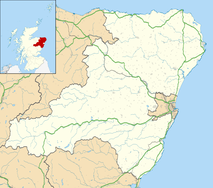
File:Aberdeenshire UK location map.svg
Appearance

Size of this PNG preview of this SVG file: 682 × 600 pixels. Other resolutions: 273 × 240 pixels | 546 × 480 pixels | 873 × 768 pixels | 1,165 × 1,024 pixels | 2,329 × 2,048 pixels | 1,425 × 1,253 pixels.
Original file (SVG file, nominally 1,425 × 1,253 pixels, file size: 1.84 MB)
File history
Click on a date/time to view the file as it appeared at that time.
| Date/Time | Thumbnail | Dimensions | User | Comment | |
|---|---|---|---|---|---|
| current | 19:59, 26 September 2010 |  | 1,425 × 1,253 (1.84 MB) | Nilfanion | {{Information |Description=Blank map of Aberdeenshire, UK with the following information shown: *Administrative borders *Coastline, lakes and rivers *Roads and railways *Urban areas Equirectangular map projection on WGS 84 datum, with |
File usage
More than 100 pages use this file. The following list shows the first 100 pages that use this file only. A full list is available.
- Aberchirder
- Aberdeenshire
- Aberdeenshire Council
- Aboyne
- Aden Country Park
- Alford, Aberdeenshire
- Arbuthnott
- Ballater
- Balmedie
- Balmoor Stadium
- Balmoral Castle
- Banchory
- Banff, Aberdeenshire
- Barthol Chapel
- Battle of Lumphanan
- Bellabeg
- Braemar
- Braemar Castle
- Buchanhaven
- Bullers of Buchan
- Campbell Hospital, Portsoy
- Christie Park, Huntly
- Cornhill, Aberdeenshire
- Crathes Castle
- Crathie, Aberdeenshire
- Crathie Kirk
- Crimond
- Crimond Church
- Cruden Bay
- Drum Castle
- Drumoak
- Dunecht
- Dunnottar Castle
- Durris transmitting station
- Echt, Aberdeenshire
- Ellon, Aberdeenshire
- Fettercairn
- Finzean
- Fordoun
- Foveran
- Fraserburgh
- Fyvie
- Gardenstown
- Gight
- Glen o' Dee Hospital
- Huntly
- Huntly Castle
- Insch
- Insch War Memorial Hospital
- Inverallochy and Cairnbulg
- Inverbervie
- Inverurie
- Inverurie Hospital
- Johnshaven
- Jubilee Hospital, Huntly
- Kemnay, Aberdeenshire
- Kildrummy Castle
- Kincardine Community Hospital
- Kinmuck
- Kinnaird Head
- Kintore, Aberdeenshire
- Laurencekirk
- Leslie Castle
- List of monastic houses in Scotland
- Longside
- Lumphanan
- Macduff, Aberdeenshire
- Maud, Aberdeenshire
- Maud Hospital
- Methlick
- Mintlaw
- New Deer
- New Slains Castle
- Newburgh, Aberdeenshire
- Newmachar
- Newtonhill
- Old Deer
- Oldmeldrum
- Oyne
- Pennan
- Peterhead
- Peterhead Community Hospital
- Pitmedden
- Portlethen
- Portsoy
- Princess Royal Park
- RNAS Rattray
- Rosehearty
- St Cyrus
- St Fergus
- Stonehaven
- Stonehaven Tolbooth
- Strichen
- Strichen stone circle
- Tarland
- Tewel
- Torphins
- Towie, Aberdeenshire
- Turriff
- Turriff Cottage Hospital
View more links to this file.
Global file usage
The following other wikis use this file:
- Usage on ar.wikipedia.org
- Usage on az.wikipedia.org
- Usage on ba.wikipedia.org
- Usage on bg.wikipedia.org
- Usage on ceb.wikipedia.org
- Usage on de.wikipedia.org
- Usage on eo.wikipedia.org
- Usage on es.wikipedia.org
- Wikiproyecto:Ilustración/Taller de Cartografía/Realizaciones/Europa
- Plantilla:Mapa de localización de Aberdeenshire
- Alford (Aberdeenshire)
- Hatton of Cruden
- Huntly
- Gourdon (Aberdeenshire)
- Gardenstown
- Insch
- Fraserburgh
- Inverallochy and Cairnbulg
- Inverbervie
- Blackburn (Aberdeenshire)
- Banff (Aberdeenshire)
- Ellon (Aberdeenshire)
- Ballater
- Balmedie
- Drumoak
- Auchenblae
- Boddam
- Crimond
- Aboyne
- Aberchirder
- Peterhead
- Longside
- Laurencekirk
- Kintore (Aberdeenshire)
- Macduff
- Kingseat (Aberdeenshire)
- Inverurie
- Kemnay
- Portlethen
- Marywell
- Maud (Aberdeenshire)
View more global usage of this file.
