File:403 near Jerseyville.png
Appearance

Size of this preview: 800 × 533 pixels. Other resolutions: 320 × 213 pixels | 640 × 427 pixels | 1,024 × 682 pixels | 1,280 × 853 pixels | 3,028 × 2,018 pixels.
Original file (3,028 × 2,018 pixels, file size: 10.03 MB, MIME type: image/png)
Summary
[edit]| Description |
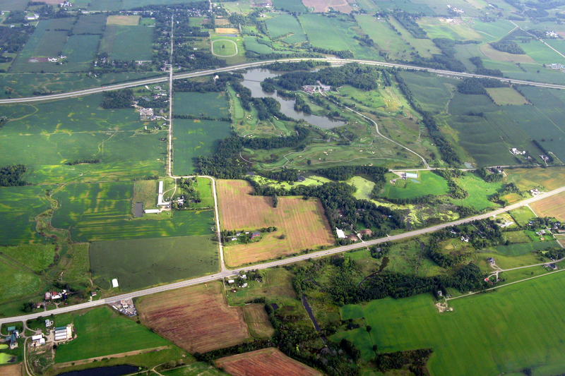
Aerial view of Highway 403 (further) and former Highway 2 / 53 (closer). The community in the background is Jerseyville, Ontario. The lake is Dunmark Lake. |
|---|---|
| Source |
Derivative of Southern Ontario from the Air |
| Date |
August 28, 2008 |
| Author | |
| Permission (Reusing this file) |
See below.
|
| The uploader or another editor requests that a local copy of this file be kept. This image or media file may be available on the Wikimedia Commons as File:403 near Jerseyville.png, where categories and captions may be viewed. While the license of this file may be compliant with the Wikimedia Commons, an editor has requested that the local copy be kept too. This file does not meet CSD F8 and should not be tagged as a Commons duplicate. If you desire to nominate it for deletion, notify the tagging editor. |
Licensing
[edit]| This work is licensed under the Creative Commons Attribution-ShareAlike 3.0 License. |
File history
Click on a date/time to view the file as it appeared at that time.
| Date/Time | Thumbnail | Dimensions | User | Comment | |
|---|---|---|---|---|---|
| current | 15:43, 22 October 2011 |  | 3,028 × 2,018 (10.03 MB) | Floydian (talk | contribs) | {{Information |Description=Aerial view of Highway 403 (further) and former Highway 2 / 53 (closer). The community in the background is Jerseyville, Ontario. The lake is Dunmark Lake. |Source=Derivative of [http://www.flickr.com/photos/paulhami/2813736 |
You cannot overwrite this file.
File usage
The following file is a duplicate of this file (more details):
- File:403 near Jerseyville.png from Commons
The following 2 pages use this file:
