Jump to content

File:2021 Palawan division plebiscite results.svg

Page contents not supported in other languages.
This is a file from the Wikimedia Commons
From Wikipedia, the free encyclopedia

Original file (SVG file, nominally 2,145 × 1,865 pixels, file size: 202 KB)

Summary

Description
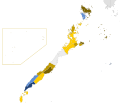
English: Results of the 2021 Palawan division plebiscite.
 
This W3C-unspecified vector image was created with Inkscape .
Date (UTC)
Source This file was derived from: PhlMapCit.svg
Author
This is a retouched picture, which means that it has been digitally altered from its original version. The original can be viewed here: PhlMapCit.svg.

Licensing

w:en:Creative Commons
attribution share alike
This file is licensed under the Creative Commons Attribution-Share Alike 3.0 Unported license.
Attribution: Felipe Aira and Hariboneagle927
You are free:
  • to share – to copy, distribute and transmit the work
  • to remix – to adapt the work
Under the following conditions:
  • attribution – You must give appropriate credit, provide a link to the license, and indicate if changes were made. You may do so in any reasonable manner, but not in any way that suggests the licensor endorses you or your use.
  • share alike – If you remix, transform, or build upon the material, you must distribute your contributions under the same or compatible license as the original.
This licensing tag was added to this file as part of the GFDL licensing update.

Original upload log

This image is a derivative work of the following images:

  • File:PhlMapCit.svg licensed with Cc-by-sa-3.0-migrated, GFDL, GFDL-user
    • 2019-05-29T02:12:06Z HueMan1 4751x6104 (2417908 Bytes) Added missing borders in Lanao del Sur and Bukidnon; Fixed boundaries in Isabela, and some of Rizal and Cebu; Fixed the coastlines of Panay and Cebu Islands. (Aklan, Negros Occidental, and Maguindanao boundaries are still inc
    • 2019-04-10T03:17:19Z HueMan1 4751x6104 (2762350 Bytes) Revised version. Added Davao Occidental.
    • 2008-12-18T12:05:41Z Felipe Aira 4751x6104 (2602003 Bytes) iwinastong bersyon
    • 2008-12-04T13:23:50Z Felipe Aira 4751x6104 (2714929 Bytes) {{Information |Description= {{tgl|1=Mga bayan at lungsod ng Pilipinas}}{{en|1=Towns and cities of the Philippines}}{{Inkscape}} |Source=Own work by uploader |Author=[[User:Felipe Aira|Felipe Aira]] |Date=Disyembre 6, 2008 |

Uploaded with derivativeFX

Captions

Add a one-line explanation of what this file represents

Items portrayed in this file

depicts

image/svg+xml

f91e8aace33c7755a4fac7e59c8dd012e34560ae

206,955 byte

1,865 pixel

2,145 pixel

File history

Click on a date/time to view the file as it appeared at that time.

Date/TimeThumbnailDimensionsUserComment
current13:01, 19 March 2021Thumbnail for version as of 13:01, 19 March 20212,145 × 1,865 (202 KB)Hariboneagle927add white background, and adjust the inset, so the border is not too close to the Palawan mainland; purely cosmetic changes
01:38, 16 March 2021Thumbnail for version as of 01:38, 16 March 20212,145 × 1,865 (202 KB)HueMan1The Brexit referendum map has no background
16:00, 15 March 2021Thumbnail for version as of 16:00, 15 March 20212,145 × 1,865 (417 KB)Howard the DuckBrought Kalayaan closer
15:49, 15 March 2021Thumbnail for version as of 15:49, 15 March 20212,980 × 1,865 (422 KB)Howard the DuckSwitching back to blue and yellow. Bangsamoro and Brexit referendums used this color scheme. Red and green is also bad for people who are color blind.
15:18, 15 March 2021Thumbnail for version as of 15:18, 15 March 20211,806 × 1,836 (388 KB)HueMan1tweak; mapped Kalayaan out for cartographic convenience.
15:00, 15 March 2021Thumbnail for version as of 15:00, 15 March 20212,980 × 1,865 (420 KB)HueMan1Green and red
05:26, 15 March 2021Thumbnail for version as of 05:26, 15 March 20212,980 × 1,865 (420 KB)Howard the DuckUpdate: Culion voted "YES". Others that had no results yet all voted "NO".
15:43, 14 March 2021Thumbnail for version as of 15:43, 14 March 20212,980 × 1,865 (420 KB)HueMan1Update
18:48, 25 December 2020Thumbnail for version as of 18:48, 25 December 20202,980 × 1,865 (439 KB)Hariboneagle927crop
18:47, 25 December 2020Thumbnail for version as of 18:47, 25 December 20202,978 × 1,925 (439 KB)Hariboneagle927== {{int:filedesc}} == {{Information |Description={{en|1=Blank map of Palawan's municipalities}}{{Inkscape}} |Source={{Derived from|PhlMapCit.svg|display=50}} |Date=2020-12-25 18:46 (UTC) |Author=* File:PhlMapCit.svg: Felipe Aira * derivative work: [[User:{{subst:REVISIONUSER}}|{{subst:REVISIONUSER}}]] |Permission= |other_versions= }} {{RetouchedPicture||editor=|orig=PhlMapCit.svg}} == {{int:license-header}} == {{self|Cc-by-sa-3.0-migrated|GFDL|G...

The following page uses this file:

Global file usage

The following other wikis use this file:

Metadata