
File:2019 Philippine measles outbreak map.png
Size of this preview: 384 × 599 pixels. Other resolutions: 154 × 240 pixels | 308 × 480 pixels | 492 × 768 pixels | 656 × 1,024 pixels | 2,000 × 3,120 pixels.
Original file (2,000 × 3,120 pixels, file size: 164 KB, MIME type: image/png)
| This is a file from the Wikimedia Commons. Information from its description page there is shown below. Commons is a freely licensed media file repository. You can help. |
Summary
| Description |
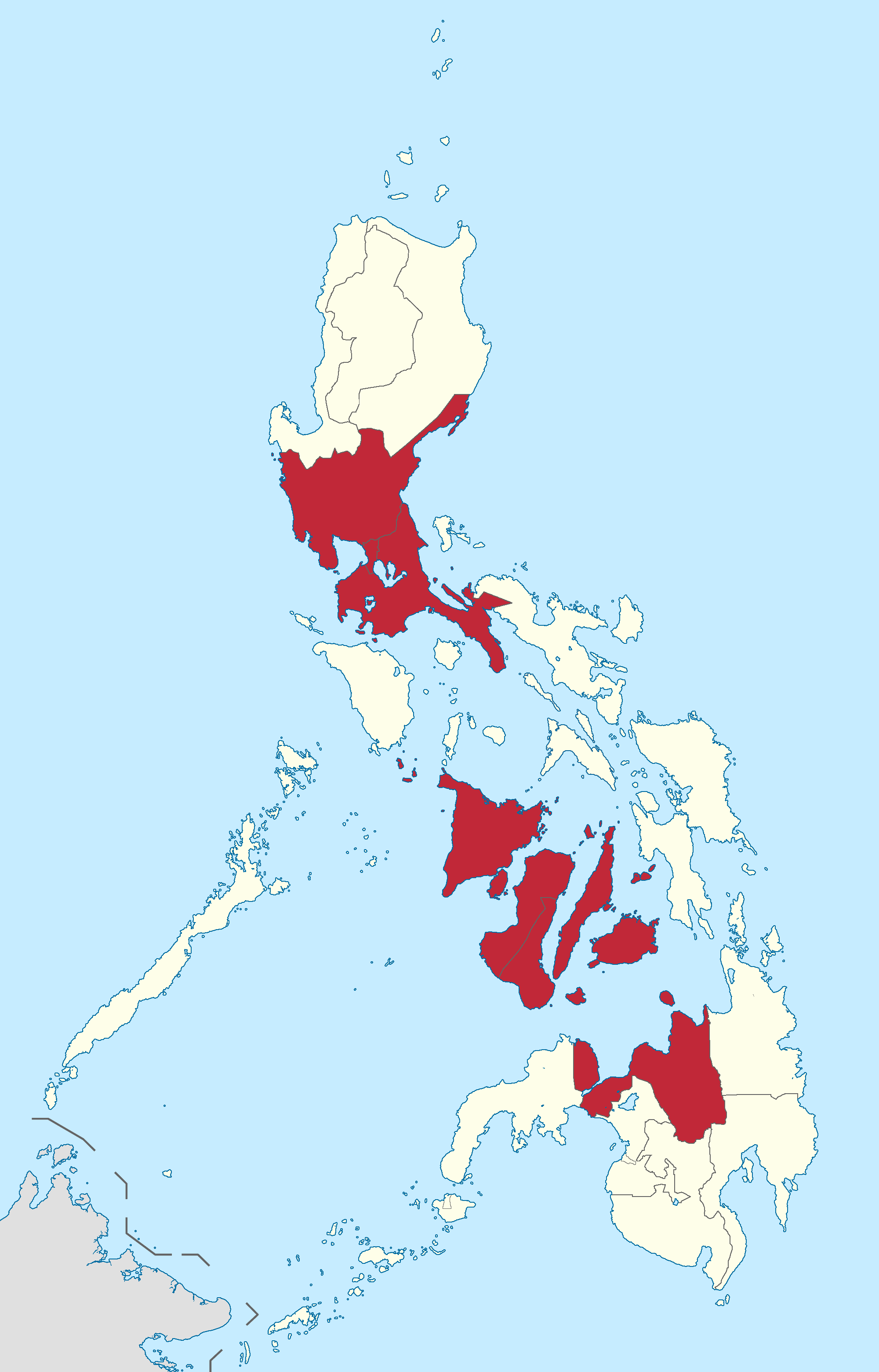
English: 2019 Philippines measles outbreak; Map displaying the regions where a measles outbreak has been officially declared by the Department of Health. |
| Date | |
| Source | Derived from Namayan's Ph fil region locator maps series. |
| Author |
BlankMap-Philippines.png by The Cofee
|
Licensing
This file is licensed under the Creative Commons Attribution-Share Alike 3.0 Unported license.
- You are free:
- to share – to copy, distribute and transmit the work
- to remix – to adapt the work
- Under the following conditions:
- attribution – You must give appropriate credit, provide a link to the license, and indicate if changes were made. You may do so in any reasonable manner, but not in any way that suggests the licensor endorses you or your use.
- share alike – If you remix, transform, or build upon the material, you must distribute your contributions under the same or compatible license as the original.
File history
Click on a date/time to view the file as it appeared at that time.
| Date/Time | Thumbnail | Dimensions | User | Comment | |
|---|---|---|---|---|---|
| current | 07:31, 25 February 2019 | | 2,000 × 3,120 (164 KB) | Hariboneagle927 | update |
| 15:17, 20 February 2019 |  | 2,000 × 3,120 (163 KB) | Hariboneagle927 | Reverted to version as of 05:30, 11 February 2019 (UTC) Even the DOH contradicts themselves regarding this. Following WHO cite on the relevant article. | |
| 05:54, 11 February 2019 |  | 2,000 × 3,120 (163 KB) | Hariboneagle927 | Correction the DOH website says Eastern Visayas and not Western. | |
| 05:30, 11 February 2019 |  | 2,000 × 3,120 (163 KB) | Hariboneagle927 | User created page with UploadWizard |
File usage
The following 2 pages use this file:
Global file usage
The following other wikis use this file:
- Usage on tl.wikipedia.org
- Usage on zh.wikipedia.org