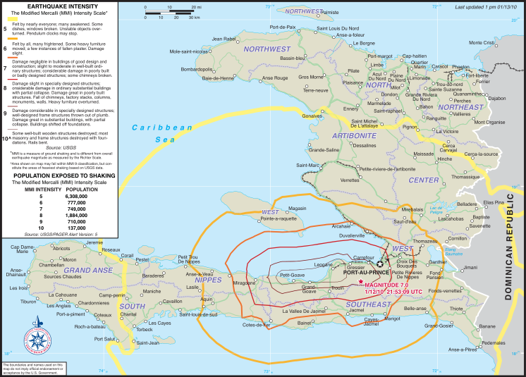
File:2010 Haiti earthquake USAID intensity map.svg
Appearance

Size of this PNG preview of this SVG file: 746 × 535 pixels. Other resolutions: 320 × 229 pixels | 640 × 459 pixels | 1,024 × 734 pixels | 1,280 × 918 pixels | 2,560 × 1,836 pixels.
Original file (SVG file, nominally 746 × 535 pixels, file size: 2.45 MB)
File history
Click on a date/time to view the file as it appeared at that time.
| Date/Time | Thumbnail | Dimensions | User | Comment | |
|---|---|---|---|---|---|
| current | 00:43, 16 January 2010 |  | 746 × 535 (2.45 MB) | Clindberg | Remove outside-the-border stuff |
| 00:37, 16 January 2010 |  | 806 × 620 (2.52 MB) | Clindberg | {{Information |Description=Intensity map for the w:2010 Haiti earthquake |Source=[http://www.defense.gov/home/features/2010/0110%5Fhaiti/ defense.gov Haiti page], as one of the slideshow images, and presumably also at some point on the [http://www.us |
File usage
The following page uses this file:

