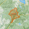
File:2000 Storrie Fire map 1.png
Appearance

Size of this preview: 463 × 599 pixels. Other resolutions: 185 × 240 pixels | 371 × 480 pixels | 593 × 768 pixels | 791 × 1,024 pixels | 1,582 × 2,048 pixels | 4,250 × 5,500 pixels.
Original file (4,250 × 5,500 pixels, file size: 26.12 MB, MIME type: image/png)
File history
Click on a date/time to view the file as it appeared at that time.
| Date/Time | Thumbnail | Dimensions | User | Comment | |
|---|---|---|---|---|---|
| current | 02:02, 4 September 2024 |  | 4,250 × 5,500 (26.12 MB) | Penitentes | updated map format |
| 03:04, 14 March 2024 |  | 2,500 × 2,500 (9.93 MB) | Penitentes | Improved map symbology, higher resolution, added north arrow and scale | |
| 06:40, 23 January 2023 |  | 1,300 × 1,300 (3.15 MB) | Penitentes | Improved crop and legibility, map details | |
| 04:15, 13 January 2023 |  | 1,300 × 1,300 (3.04 MB) | Penitentes | Uploaded own work with UploadWizard |
File usage
The following 2 pages use this file:
