File:1st-SOUSE-sensors.png
Appearance
1st-SOUSE-sensors.png (300 × 280 pixels, file size: 155 KB, MIME type: image/png)
File history
Click on a date/time to view the file as it appeared at that time.
| Date/Time | Thumbnail | Dimensions | User | Comment | |
|---|---|---|---|---|---|
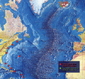
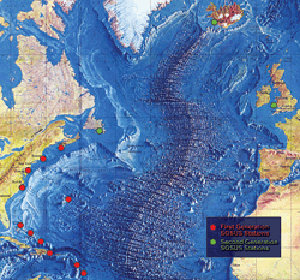
| current | 00:51, 5 August 2008 |  | 300 × 280 (155 KB) | Matrek | {{Information |Description={{en|1=The first SOSUS stations – NAVFACs – were sited from Barbados to Nova Scotia on a huge semi-circle that opened onto the deepwater abyss west of the Mid-Atlantic Ridge. Later, additional Atlantic-area stations were est |
File usage
The following 2 pages use this file:
Global file usage
The following other wikis use this file:
- Usage on es.wikipedia.org
- Usage on et.wikipedia.org
- Usage on fr.wikipedia.org
- Usage on id.wikipedia.org
- Usage on it.wikipedia.org
- Usage on ko.wikipedia.org
- Usage on pl.wikipedia.org
- Usage on sv.wikipedia.org
- Usage on vi.wikipedia.org
- Usage on zh.wikipedia.org


