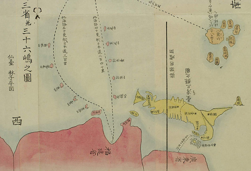
File:1786年中国往琉球海路图2.jpg
Appearance

Size of this preview: 800 × 545 pixels. Other resolutions: 320 × 218 pixels | 640 × 436 pixels | 1,024 × 697 pixels | 1,280 × 871 pixels | 2,130 × 1,450 pixels.
Original file (2,130 × 1,450 pixels, file size: 325 KB, MIME type: image/jpeg)
File history
Click on a date/time to view the file as it appeared at that time.
| Date/Time | Thumbnail | Dimensions | User | Comment | |
|---|---|---|---|---|---|
| current | 08:54, 6 February 2013 |  | 2,130 × 1,450 (325 KB) | MaxxL | cropped again |
| 14:44, 14 September 2010 |  | 2,172 × 1,488 (922 KB) | Winstonlighter | cropped version | |
| 18:57, 9 September 2010 |  | 2,592 × 1,728 (284 KB) | Ixioini | {{Information |Description={{zh|1=在1786年(清乾隆五十一年)日本仙台人 林子平 制作的《三国通览图说》之《琉球国全图》中显示福建前往琉球中山南北两条海路路线,其中南路标示花瓶屿、彭佳山� |
File usage
The following 2 pages use this file:
Global file usage
The following other wikis use this file:
- Usage on de.wikipedia.org
- Usage on es.wikipedia.org
- Usage on fr.wikipedia.org
- Usage on hy.wikipedia.org
- Usage on it.wikipedia.org
- Usage on ja.wikipedia.org
- Usage on nn.wikipedia.org
- Usage on no.wikipedia.org
- Usage on ru.wikipedia.org
- Usage on th.wikipedia.org
- Usage on zh.wikipedia.org
