Jump to content

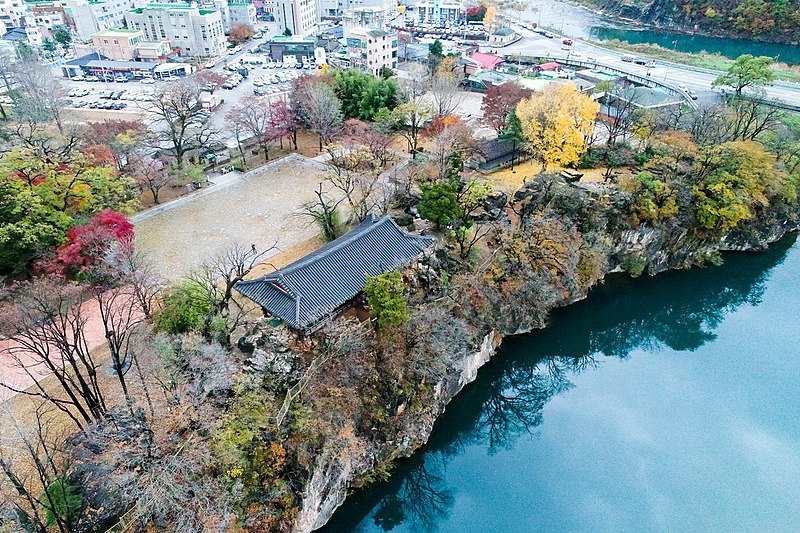
File:삼척 죽서루와 오십천- 강원도청.jpg

Page contents not supported in other languages.
This is a file from the Wikimedia Commons
From Wikipedia, the free encyclopedia

Original file (1,200 × 800 pixels, file size: 777 KB, MIME type: image/jpeg)

Summary

Description
한국어: 삼척 죽서루(三陟 竹西樓)는 강원도 삼척시에 위치한 누각으로, 관동팔경 중의 하나이다. 다른 관동팔경의 누, 정이 바다를 끼고 있는 것과는 달리 죽서루만이 유일하게 강을 끼고 있다.
Date
Source https://www.kogl.or.kr/recommend/recommendDivView.do?recommendIdx=8236&division=img
Author 강원도청
Camera location37° 26′ 27.52″ N, 129° 09′ 35.82″ E Kartographer map based on OpenStreetMap.View this and other nearby images on: OpenStreetMapinfo

Licensing

KOGL Type 1

This file is licensed under the Korea Open Government License Type I: Attribution.
You are free:
  • to share – to copy, distribute and transmit the work online or offline, for commercial or non-commercial purposes
  • to remix – to adapt the work
Under the following conditions:
  • attribution – You must specify the source of the work.

Captions

Add a one-line explanation of what this file represents

Items portrayed in this file

depicts

14 November 2018

37°26'27.517"N, 129°9'35.816"E

0.00833333333333333333 second

8.8 millimetre

image/jpeg

File history

Click on a date/time to view the file as it appeared at that time.

Date/TimeThumbnailDimensionsUserComment
current13:48, 5 June 2020Thumbnail for version as of 13:48, 5 June 20201,200 × 800 (777 KB)BongsunUploaded a work by 강원도청 from 공공누리 https://www.kogl.or.kr with UploadWizard

The following page uses this file:

Global file usage

The following other wikis use this file:

Metadata