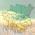
File:Карта Чечено-Ингушетия.png
Appearance

Size of this preview: 600 × 599 pixels. Other resolutions: 240 × 240 pixels | 481 × 480 pixels | 769 × 768 pixels | 1,025 × 1,024 pixels | 2,050 × 2,048 pixels | 3,574 × 3,570 pixels.
Original file (3,574 × 3,570 pixels, file size: 8.67 MB, MIME type: image/png)
File history
Click on a date/time to view the file as it appeared at that time.
| Date/Time | Thumbnail | Dimensions | User | Comment | |
|---|---|---|---|---|---|
| current | 21:57, 31 January 2020 |  | 3,574 × 3,570 (8.67 MB) | Takhirgeran Umar | об |
| 17:50, 11 April 2012 |  | 810 × 768 (1.17 MB) | Takhirgeran Umar | Река Сунжа | |
| 10:38, 10 April 2012 |  | 812 × 768 (1.17 MB) | Takhirgeran Umar | {{Information |Description ={{ru|1=Карта Чечено-Ингушетия}} |Source =Собственная работа |Author =Дагиров Умар |Date =10 апрель 2012 |Permission = |other_versions = }} |
File usage
The following page uses this file:
Global file usage
The following other wikis use this file:
- Usage on ce.wikipedia.org
- Usage on os.wikipedia.org
- Usage on ru.wikipedia.org
- Usage on ru.wiktionary.org

