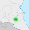
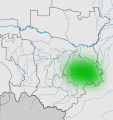
File:Карта Исторической области Ичкерия.svg
Appearance

Size of this PNG preview of this SVG file: 446 × 524 pixels. Other resolutions: 204 × 240 pixels | 408 × 480 pixels | 654 × 768 pixels | 871 × 1,024 pixels | 1,743 × 2,048 pixels.
Original file (SVG file, nominally 446 × 524 pixels, file size: 693 KB)
File history
Click on a date/time to view the file as it appeared at that time.
| Date/Time | Thumbnail | Dimensions | User | Comment | |
|---|---|---|---|---|---|
| current | 18:05, 3 March 2020 |  | 446 × 524 (693 KB) | Takhirgeran Umar | . |
| 01:46, 8 February 2020 |  | 446 × 524 (712 KB) | Takhirgeran Umar | об | |
| 06:24, 22 January 2020 |  | 446 × 456 (572 KB) | Takhirgeran Umar | об | |
| 20:29, 8 October 2012 |  | 4,798 × 5,091 (206 KB) | Takhirgeran Umar | . | |
| 19:43, 8 October 2012 |  | 4,798 × 5,091 (206 KB) | Takhirgeran Umar | . | |
| 18:30, 8 October 2012 |  | 4,798 × 5,091 (206 KB) | Takhirgeran Umar | . | |
| 14:36, 8 October 2012 |  | 4,798 × 5,091 (206 KB) | Takhirgeran Umar | User created page with UploadWizard |
File usage
The following page uses this file:
Global file usage
The following other wikis use this file:
- Usage on ca.wikipedia.org
- Usage on ce.wikipedia.org
- Usage on cs.wikipedia.org
- Usage on en.wiktionary.org
- Usage on ru.wikipedia.org
- Usage on www.wikidata.org
