Eito
Appearance
(Redirected from Eito, Cape Verde)
Eito | |
|---|---|
Settlement | |
| Coordinates: 17°08′35″N 25°01′26″W / 17.143°N 25.024°W | |
| Country | Cape Verde |
| Island | Santo Antão |
| Municipality | Paul |
| Civil parish | Santo António das Pombas |
| Population (2010)[1] | |
• Total | 979 |
| ID | 12103 |
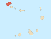
Eito is a village in the northeastern part of the island of Santo Antão, Cape Verde, part of the municipality of Paul. It is situated 1 km southwest of Pombas, 2 km northeast of Figueiral and 15 km northeast of the island capital Porto Novo. Its population was 979 in 2010.
See also
[edit]References
[edit]- ^ "2010 Census results". Instituto Nacional de Estatística Cabo Verde (in Portuguese). 24 November 2016.


