Division of McPherson
| McPherson Australian House of Representatives Division | |
|---|---|
Map Interactive map of boundaries | |
| Created | 1949 |
| MP | Karen Andrews |
| Party | Liberal National |
| Namesake | McPherson Range |
| Electors | 109,140 (2022) |
| Area | 229 km2 (88.4 sq mi) |
| Demographic | Provincial |
The Division of McPherson is an Australian Electoral Division in Queensland.
Geography
[edit]Since 1984, federal electoral division boundaries in Australia have been determined at redistributions by a redistribution committee appointed by the Australian Electoral Commission. Redistributions occur for the boundaries of divisions in a particular state, and they occur every seven years, or sooner if a state's representation entitlement changes or when divisions of a state are malapportioned.[1]
History
[edit]
The division was created in 1948 and is named after the McPherson Range, which forms one of the divisional boundaries. McPherson is located in south-east Queensland, and originally included the entire Gold Coast region, stretching as far as the Scenic Rim and Southern Downs. However, the area's dramatic population growth has seen the seat shrink with successive redistributions, culminating in 1983, when most of its northern portion became Moncrieff.
McPherson now incorporates the southern portion of the Gold Coast, including Coolangatta, Burleigh Heads, Tugun and Palm Beach.
It has always been held by a conservative party. Indeed, most of the area has been represented by centre-right MPs without interruption since 1906; before 1949, most of the Gold Coast was part of Moreton. Originally a Country Party bastion, urbanisation has turned it into a Liberal stronghold.
Members
[edit]| Image | Member | Party | Term | Notes | |
|---|---|---|---|---|---|

|
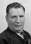
Sir Arthur Fadden (1894–1973) |
Country | 10 December 1949 – 14 October 1958 |
Previously held the Division of Darling Downs. Served as minister under Menzies. Retired | |

|
Charles Barnes (1901–1998) |
22 November 1958 – 2 November 1972 |
Served as minister under Menzies, Holt, McEwen, Gorton and McMahon. Retired | ||

|
Eric Robinson (1929–1981) |
Liberal | 2 December 1972 – 7 January 1981 |
Served as minister under Fraser. Died in office | |

|
Peter White (1936–2005) |
21 February 1981 – 19 February 1990 |
Previously held the Legislative Assembly of Queensland seat of Southport. Retired | ||

|
John Bradford (1946–) |
24 March 1990 – 7 April 1998 |
Did not contest in 1998. Failed to win a Senate seat | ||
| Christian Democratic | 7 April 1998 – 31 August 1998 | ||||

|
Margaret May (1950–) |
Liberal | 3 October 1998 – 19 July 2010 |
Retired | |

|
Karen Andrews (1960–) |
Liberal National | 21 August 2010 – present |
Served as minister under Morrison. Incumbent |
Election results
[edit]| Party | Candidate | Votes | % | ±% | |
|---|---|---|---|---|---|
| Liberal National | Karen Andrews | 42,288 | 43.56 | −4.68 | |
| Labor | Carl Ungerer | 21,354 | 22.00 | −0.85 | |
| Greens | Scott Turner | 14,971 | 15.42 | +4.43 | |
| One Nation | Kevin Hargraves | 7,013 | 7.22 | +1.36 | |
| United Australia | Joshua Berrigan | 6,490 | 6.69 | +3.36 | |
| Australian Values | Andy Cullen | 2,310 | 2.38 | +2.38 | |
| Liberal Democrats | Glenn Pyne | 2,063 | 2.12 | −1.36 | |
| Federation | Gary Pead | 594 | 0.61 | +0.61 | |
| Total formal votes | 97,083 | 94.58 | +0.91 | ||
| Informal votes | 5,565 | 5.42 | −0.91 | ||
| Turnout | 102,648 | 87.56 | −2.84 | ||
| Two-party-preferred result | |||||
| Liberal National | Karen Andrews | 57,605 | 59.34 | −2.86 | |
| Labor | Carl Ungerer | 39,478 | 40.66 | +2.86 | |
| Liberal National hold | Swing | −2.86 | |||

 indicates at what stage the winning candidate had over 50% of the votes and was declared the winner.
References
[edit]- ^ Muller, Damon (14 November 2017). "The process of federal redistributions: a quick guide". Parliament of Australia. Retrieved 19 April 2022.
- ^ McPherson, QLD, 2022 Tally Room, Australian Electoral Commission.


