List of districts in Malaysia
| Daerah (District) | |
|---|---|
 | |
| Category | Second-level administrative division |
| Location | States of Malaysia |
| Number | 160 89 with 2 cities (Peninsular) 28 (Sabah) 40 (Sarawak) 1 city (Labuan) (as of 2020 Census[1]) |
| Populations | Greatest: Petaling District, Selangor—1,812,633 (2010) Least: Pakan District, Sarawak—15,480 (2010)[2] |
| Areas | Largest: Kapit Division, Sarawak—38,934 km2 (15,033 sq mi) Smallest: Putatan District, Sabah—29.7 km2 (11.5 sq mi) |
| Government | |
| Subdivisions | |
Districts (Malay: Daerah; Jajahan in Kelantan) are a type of administrative division below the state level in Malaysia. An administrative district is administered by a lands and district office (pejabat daerah dan tanah) which is headed by district officer (pegawai daerah).
Classification
[edit]In Peninsular Malaysia, a district is a subdivision of a state. A mukim (commune, sub-district or parish) is a subdivision of a district. In recent years, a mukim is however of less importance with respect to the administration of land; for land administrative purposes, major cities (e.g. Petaling Jaya) are given an equal status with mukim.
The state of Perlis is not divided into districts due to its size, but straight to the mukim level. The Federal Territories and Labuan are also not divided into districts; however Kuala Lumpur is divided into several mukim for land administration purposes. Putrajaya is divided into precincts.
In East Malaysia, a district is a subdivision of a division (bahagian) of a state.[3] For example, Tuaran is a district within the West Coast Division of Sabah. A district is usually named after the main town or its administrative capital; for example, the town of Sandakan is the capital of the Sandakan District, as well as the capital of Sandakan Division.
Some larger districts are further divided into autonomous sub-districts (daerah kecil; literally "small district") before the mukim level. This is prevalent in Sarawak and Sabah, but also seen in Peninsular Malaysia in recent years, e.g. Lojing autonomous sub-district in Kelantan. Sub-districts in Sabah, however, are not divided into mukim.
Relationship with parliament and local government
[edit]An administrative district can be distinguished from a local government area where the former deals with land administration and revenue while the latter deals with the planning and delivery of basic infrastructure to its inhabitants. Administrative district boundaries are usually congruent with local government area boundaries, but may sometimes differ especially in urbanised areas. For example, the Petaling District in Selangor is administered by three local authorities: Petaling Jaya City Council, Shah Alam City Council and Subang Jaya City Council; conversely one local authority can administer more than one district, for example Northeast Penang Island District and Southwest Penang Island District in Penang are both administered by Penang Island City Council.
Administrative district boundaries also provide the basis of boundaries for the parliamentary constituencies in the Malaysian Parliament.[4] However this is not always the case; in heavily populated areas e.g. the Klang Valley and Kinta Valley there is serious overlap between district, local government and parliamentary boundaries.
By states
[edit]West Malaysia
[edit]East Malaysia
[edit]Townships (Mukim)
[edit]In the 11 states of the Peninsular Malaysia including the Federal Territories, there are townships (precinct for Putrajaya) that been administered by the district office and also the state government. For a list, see Category:Mukims of Malaysia. However, two states and one federal territory in Malaysia is not divided into any townships.
Gallery
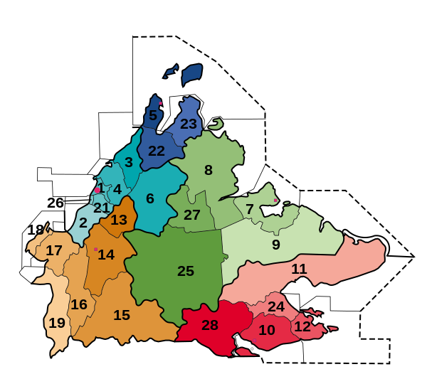
[edit]Labelled maps
[edit]


Maps
[edit]-
Districts in Johor
-
Districts in Perak
-
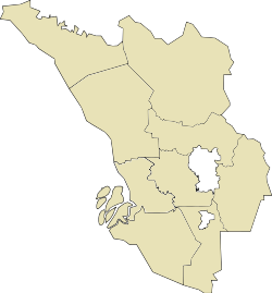
Districts in Selangor
See also
[edit]- District
- Amphoe
- County
- Governorate, Kabupaten, Regierungsbezirk, Oblast, Raion, Vilayet
- List of capitals in Malaysia
- List of districts in Malaysia by population
- Local government in Malaysia
Notes
[edit]References
[edit]- ^ "List of Administrative District, Mukim and Local Authority Area".
- ^ "The Official Portal of the Sarawak Government". www.sarawak.gov.my.
- ^ "Malaysia Districts". Statoids.com. Retrieved 3 November 2010.
- ^ "Persempadanan". Suruhanjaya Pilihan Raya (Election Commission of Malaysia). Retrieved 20 September 2020.
- ^ a b "Key Findings of Population and Housing Census of Malaysia 2020" (pdf) (in Malay and English). Department of Statistics, Malaysia. ISBN 978-967-2000-85-3.
- ^ "Membakut now a full district". www.dailyexpress.com.my. 15 October 2023.
- ^ Lian Cheng; Peter Sibon (23 January 2016). "Call for Belaga to have own district council". The Borneo Post. Retrieved 19 June 2018.
- ^ "Launch of Bukit Mabong, Tunoh, Kapit by the Chief Minister of Sarawak". Sarawak Regional Corridor Development Authority. 3 November 2015. Retrieved 28 December 2016.
- ^ "Rakan Sarawak October 2001". www.sarawak.com.my. Archived from the original on 6 June 2009.
- ^ "Laman Web Rasmi Majlis Daerah Subis".
- ^ "'Telang Usan District Office a game changer'". 7 October 2015.
- ^ "INFOGRAPHICS: NEW DISTRICTS IN SARAWAK". BERNAMA. 13 December 2021.
- ^ Lian Cheng (11 November 2016). "It's Kota Samarahan Municipal Council effective today". The Borneo Post. Retrieved 19 June 2018.
- ^ "Laman Web Rasmi Majlis Perbandaran Kota Samarahan". mpks.sarawak.gov.my.
- ^ Samuel Aubrey (12 April 2015). "Serian now a division". The Borneo Post. Retrieved 15 May 2015.
External links
[edit]- "Districts of Malaysia". Statoids.


