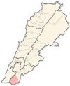
Deir Intar
Deir Intar
دير انطار | |
|---|---|
City | |
| Coordinates: 33°13′07″N 35°22′33″E / 33.21861°N 35.37583°E | |
| Grid position | 185/291 PAL |
| Country | |
| Governorate | Nabatieh |
| District | Bint Jbeil |
| Highest elevation | 670 m (2,200 ft) |
| Lowest elevation | 540 m (1,770 ft) |
| Time zone | UTC+2 (EET) |
| • Summer (DST) | UTC+3 (EEST) |
| Dialing code | +961 |
Deir Intar (Dayr Antar, Deir Entar, Arabic: دير انطار) is a small village in Southern Lebanon in the Bint Jbeil District in Nabatieh Governorate.

Geography
[edit]It is about 110 kilometres (68 mi) south of Beirut and 25 kilometres (16 mi) east of Tyre, in the heart of what is known as "Jabal Amel".
Its main features include a cave, a main square, and 3 mosques.
Location
[edit]The village is surrounded several villages including: Tibnin, As-Sultaniyah, Bir El Sanasel, Majadel, Mahrouna, Mazraat Mechref, Haris, Kfar Dounin, and other southern villages.[citation needed]
Origin of name
[edit]E. H. Palmer wrote that the name means "the convent of arches".[1]
History
[edit]In 1875 Victor Guérin visited and found here 160 Metualis.[2] He further noted: "Most of the houses show a mixture of old hewn stones and modern materials without character. Several tombs, cisterns, a great press, with two compartments, and a rock-cut tank point to a period of more or less antiquity.'[3]
In 1881, the PEF's Survey of Western Palestine (SWP) described it as: A village, built of stone, containing about 150 Metawileh, situated on a hill, surrounded by olives, fig-trees, and arable land, with waters supplied from birket and cisterns.[4]
On 4 November 2024, Israeli warplanes launched two missiles at Deir Intar Square, neither of which exploded.[5]
Municipal
[edit]Mayor: Mr. Rida Redwan Hojeij
Monuments
[edit]Religious monuments
[edit]There are mosques:[citation needed]
- Mosque Imam Mahdi (Almallule)
- Mosque Imam Hussein (Al-Barakah)
- Mosque Imam Ali (Al-shajara)
- Mosque Al-Hamra
The Imam or khatib of Deyrintar are:
- Sheikh Houssain Alatrash
- Sheikh Haitham Youssef Hjej
Civilian facilities
[edit]- The municipal building[citation needed]
- The public square
Demographics
[edit]In 2014 Muslims made up 98,91% of registered voters in Deir Intar. 97,86% of the voters were Shiite Muslims.[6]
References
[edit]- ^ Palmer, 1881, p. 20
- ^ Guerin, 1880, p. 405
- ^ Guerin, 1880, p. 405; as given in Conder and Kitchener, 1881, SWP I, p. 115
- ^ Conder and Kitchener, 1881, SWP I, p. 91
- ^ "Security update: Israeli enemy warplanes raids Deir Intar Square with two missiles, targets building on Haboush-Nabatieh road, artillery shelling of Khiyam town, multiple southern towns". NNA. 4 November 2024. Retrieved 9 November 2024.
- ^ https://lub-anan.com/المحافظات/النبطية/بنت-جبيل/دير-انطار/المذاهب/
Bibliography
[edit]- Conder, C.R.; Kitchener, H.H. (1881). The Survey of Western Palestine: Memoirs of the Topography, Orography, Hydrography, and Archaeology. Vol. 1. London: Committee of the Palestine Exploration Fund.
- Guérin, V. (1880). Description Géographique Historique et Archéologique de la Palestine (in French). Vol. 3: Galilee, pt. 2. Paris: L'Imprimerie Nationale.
- Palmer, E.H. (1881). The Survey of Western Palestine: Arabic and English Name Lists Collected During the Survey by Lieutenants Conder and Kitchener, R. E. Transliterated and Explained by E.H. Palmer. Committee of the Palestine Exploration Fund.
External links
[edit]- Survey of Western Palestine, Map 2: IAA, Wikimedia commons
- Deir Ntar, Localiban


