Jump to content

List of geological features on Rhea

From Wikipedia, the free encyclopedia
(Redirected from Craters of Rhea)

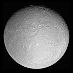
This is a list of named geological features on Rhea, the second largest moon of Saturn.[1] Planetary features are approved by the International Astronomical Union's (IAU) Working Group for Planetary System Nomenclature (WGPSN).[2]

Catenae

[edit]

A catena /kəˈtnə/ is a crater chain.

Name Coordinates Diameter (km) Approval Date Named After Notes Ref
Koykamou Catena 70°S 244°W / 70°S 244°W / -70; -244 (Koykamou) 110 6 August 2010 Koykamou, a mountain in Nganasan mythology WGPSN
Mouru Catena 48°30′N 343°30′W / 48.5°N 343.5°W / 48.5; -343.5 (Mouru) 80 6 August 2010 Merv, holy land in Persian mythology WGPSN
Onokoro Catenae 44°42′S 328°30′W / 44.7°S 328.5°W / -44.7; -328.5 (Onokoro) 240 6 August 2010 Onokoro, mythical island in Japanese mythology WGPSN
Puchou Catenae 32°N 87°W / 32°N 87°W / 32; -87 (Puchou) 620 6 August 2010 Pu Chou Mountain in Chinese mythology Formerly classified as a chasma WGPSN
Thebeksan Catena 39°30′S 174°00′W / 39.5°S 174°W / -39.5; -174 (Thebeksan) 220 6 August 2010 Thebeksan, holy mountain in Korean mythology WGPSN
Wungaran Catenae 22°30′N 79°00′W / 22.5°N 79°W / 22.5; -79 (Wungaran) 350 6 August 2010 Wungaran, sacred place in Kakadu, Australia WGPSN

Chasmata

[edit]

Rhean chasms are called chasmata. They are named after sacred places in world mythologies.

Chasma Named after
Avaiki Chasmata Avaiki, the underworld in Cook Islands mythology
Galunlati Chasmata ᎦᎸᎳᏗ galvladi (galvv́ládii) "the above": the land above the sky in Cherokee mythology
Kun Lun Chasma was reclassified as a linea in 2010 (see below)
Pu Chou Chasma was reclassified as a catena in 2010 (see above)
Pulag Chasma Pulag, sacred mountain in Igorot mythology
Vaupas Chasma Vaupas, a river in the mythology of the Cuebo of Colombia
Yamsi Chasmata Yamsi, lodge of the North Wind in Klamath mythology

Craters

[edit]

Rhean craters are named after figures from the mythologies of mostly non-European cultures. As of 2017, there are 128 named craters.[3]

Crater Coordinate Named after
Aananin 34°54′N 339°54′W / 34.9°N 339.9°W / 34.9; -339.9 Aananin (Korean)
Abassi 21°18′S 146°30′W / 21.3°S 146.5°W / -21.3; -146.5 Abassi (Efik)
Adjua 40°12′N 118°54′W / 40.2°N 118.9°W / 40.2; -118.9 Adjua (Ulch people of Siberia)
Agunua 63°18′N 66°12′W / 63.3°N 66.2°W / 63.3; -66.2 Agunua (Solomon Islands)
Ameta 53°18′N 21°54′W / 53.3°N 21.9°W / 53.3; -21.9 Ameta (Seram, Indonesia)
Anguta 25°42′N 190°00′W / 25.7°N 190.0°W / 25.7; -190.0 Anguta (Inuit)
Arunaka 15°18′S 22°06′W / 15.3°S 22.1°W / -15.3; -22.1 Arunaka (Incan)
Atum 47°06′S 1°06′W / 47.1°S 1.1°W / -47.1; -1.1 Atum (Egyptian)
Awonawilona 37°18′S 150°18′W / 37.3°S 150.3°W / -37.3; -150.3 Awonawilona (Zuni)
Bulagat 38°12′S 15°12′W / 38.2°S 15.2°W / -38.2; -15.2 Bulagat (Buryat people of Siberia)
Bumba 63°06′N 50°24′W / 63.1°N 50.4°W / 63.1; -50.4 Bumba (Bushongo people of the Congo)
Burkhan 66°48′N 310°36′W / 66.8°N 310.6°W / 66.8; -310.6 Burkhan (Buryat people of Siberia)
Chingaso 17°06′S 106°00′W / 17.1°S 106.0°W / -17.1; -106.0 Chingaso (Jivaro)
Con 25°48′S 12°42′W / 25.8°S 12.7°W / -25.8; -12.7 Kon (Incan)
Dangun 7°12′N 208°00′W / 7.2°N 208.0°W / 7.2; -208.0 Dangun (Korean)
Djuli 31°12′S 46°42′W / 31.2°S 46.7°W / -31.2; -46.7 Djuli (Neghidahan people of Ukraine)
Dohitt 18°00′S 74°06′W / 18.0°S 74.1°W / -18.0; -74.1 Dohitt (Mosetene, people of north Bolivia)
Ellyay 71°24′N 91°48′W / 71.4°N 91.8°W / 71.4; -91.8 Ellyay (Yakut people of Siberia)
Faro 45°18′N 114°00′W / 45.3°N 114.0°W / 45.3; -114.0 Faro (Mandé peoples of West Africa)
Fatu 7°42′N 176°06′W / 7.7°N 176.1°W / 7.7; -176.1 Fatu (Samoan)
Gborogboro 12°42′S 162°12′W / 12.7°S 162.2°W / -12.7; -162.2 Gborogboro (Lugbara)
Gmerti 52°00′S 192°36′W / 52.0°S 192.6°W / -52.0; -192.6 Gmerti (Georgian)
Gucumatz 37°00′N 175°48′W / 37.0°N 175.8°W / 37.0; -175.8 Gukumatz (Maya)
Haik 36°36′S 29°18′W / 36.6°S 29.3°W / -36.6; -29.3 Haik (Armenian)
Haoso 8°18′N 12°30′W / 8.3°N 12.5°W / 8.3; -12.5 Haoso (Manchuria)
Heller 10°06′N 315°06′W / 10.1°N 315.1°W / 10.1; -315.1 Heller (Auracanin)
Huracan 53°12′N 188°30′W / 53.2°N 188.5°W / 53.2; -188.5 Huracan (Kiche)
Imberombera 33°18′S 216°42′W / 33.3°S 216.7°W / -33.3; -216.7 Imberombera (Kakadu)
Inktomi 14°06′S 112°06′W / 14.1°S 112.1°W / -14.1; -112.1 Iktomi (Lakota)
Inmar 2°18′S 301°36′W / 2.3°S 301.6°W / -2.3; -301.6 Inmar (Udmurtian)
Iraca 39°24′N 112°06′W / 39.4°N 112.1°W / 39.4; -112.1 Iraca (Incan)
Izanagi 49°24′S 310°12′W / 49.4°S 310.2°W / -49.4; -310.2 Izanagi (Japanese)
Izanami 46°18′S 313°24′W / 46.3°S 313.4°W / -46.3; -313.4 Izanami (Japanese)
Jumo 52°48′N 66°30′W / 52.8°N 66.5°W / 52.8; -66.5 Jumo (Mari people of the Volga)
Karora 5°54′N 20°06′W / 5.9°N 20.1°W / 5.9; -20.1 Karora (Aranda people of Australia)
Khado 41°36′N 359°06′W / 41.6°N 359.1°W / 41.6; -359.1 Khado (Nganasan)
Kiho 11°06′S 358°42′W / 11.1°S 358.7°W / -11.1; -358.7 Kiho (Polynesian)
Kuksu 25°18′N 288°42′W / 25.3°N 288.7°W / 25.3; -288.7 Kuksu (Pomo)
Kuma 10°00′N 277°12′W / 10.0°N 277.2°W / 10.0; -277.2 Kuma (Yaruro)
Kumpara 9°36′N 327°06′W / 9.6°N 327.1°W / 9.6; -327.1 Kumpara (Jivaro people of Ecuador)
Leza 21°48′S 309°12′W / 21.8°S 309.2°W / -21.8; -309.2 Leza (Tongan)
Lowa 40°54′N 16°36′W / 40.9°N 16.6°W / 40.9; -16.6 Lowa (Marshall Islands)
Luli 46°30′N 243°06′W / 46.5°N 243.1°W / 46.5; -243.1 Luli (Mansi)
Madumda 36°54′S 64°48′W / 36.9°S 64.8°W / -36.9; -64.8 Madumda (Pomo)
Maheo 31°36′N 281°42′W / 31.6°N 281.7°W / 31.6; -281.7 Maheo (Cheyenne)
Malunga 65°06′N 56°12′W / 65.1°N 56.2°W / 65.1; -56.2 Malunga (Bantu)
Mamaldi 14°N 184°W / 14°N 184°W / 14; -184 Mamaldi (Nanai) (Tungusic people of the Amur River area)
Manoid 29°30′N 8°30′W / 29.5°N 8.5°W / 29.5; -8.5 Manoid (Negrito people of the Malay Peninsula)
Melo 53°12′S 7°06′W / 53.2°S 7.1°W / -53.2; -7.1 Melo (Minyong people of India)
Mubai 55°48′N 20°12′W / 55.8°N 20.2°W / 55.8; -20.2 Mubai (Tibetan)
Napi 26°54′N 174°48′W / 26.9°N 174.8°W / 26.9; -174.8 Napi (Blackfoot)
Nishanu 9°00′S 129°00′W / 9.0°S 129.0°W / -9.0; -129.0 Nishanu (Arikara)
Num 24°00′N 92°42′W / 24.0°N 92.7°W / 24.0; -92.7 Num (Samoyed)
Nzame 9°00′N 24°54′W / 9.0°N 24.9°W / 9.0; -24.9 Nzame (Fang)
Obatala 1°06′S 269°42′W / 1.1°S 269.7°W / -1.1; -269.7 Obatala (Yoruba)
Olorun 24°42′N 155°24′W / 24.7°N 155.4°W / 24.7; -155.4 Olorun (Yoruba)
Ormazd 52°30′N 58°30′W / 52.5°N 58.5°W / 52.5; -58.5 Ormazd (Zoroastrian)
Pachacamac 23°24′S 83°42′W / 23.4°S 83.7°W / -23.4; -83.7 Pachacamac (Inca)
Pan Ku 65°42′N 107°42′W / 65.7°N 107.7°W / 65.7; -107.7 Pan Ku (Hmong)
Pedn 46°00′N 351°42′W / 46.0°N 351.7°W / 46.0; -351.7 Pedn (Negrito people of the Malay Peninsula)
Pokoh 71°42′S 326°24′W / 71.7°S 326.4°W / -71.7; -326.4 Pokoh (Pallawonaps)
Pouliuli 16°54′S 284°24′W / 16.9°S 284.4°W / -16.9; -284.4 Pouliuli (Hawaiian)
Powehiwehi 8°12′S 280°24′W / 8.2°S 280.4°W / -8.2; -280.4 Powehiwehi (Hawaiian)
Puntan 33°54′N 292°24′W / 33.9°N 292.4°W / 33.9; -292.4 Puntan (Chamorro)
Qat 23°48′S 351°36′W / 23.8°S 351.6°W / -23.8; -351.6 Qat (New Hebrides)
Samni 47°42′S 90°42′W / 47.7°S 90.7°W / -47.7; -90.7 Samni (Kachins)
Seveki 12°54′N 164°42′W / 12.9°N 164.7°W / 12.9; -164.7 Seveki (Evenki)
Shedi 53°30′S 346°48′W / 53.5°S 346.8°W / -53.5; -346.8 Shedi (Minyong)
Sholmo 12°00′N 346°24′W / 12.0°N 346.4°W / 12.0; -346.4 Sholmo (Buryat people of Siberia)
Taaroa 16°30′N 95°30′W / 16.5°N 95.5°W / 16.5; -95.5 Ta'aroa (Hawaiian)
Tane 12°30′S 57°24′W / 12.5°S 57.4°W / -12.5; -57.4 Tāne (Māori)
Tawa 17°54′N 175°12′W / 17.9°N 175.2°W / 17.9; -175.2 Tawa (Hopi)
Thunupa 45°36′N 21°18′W / 45.6°N 21.3°W / 45.6; -21.3 Thunpa (Incan)
Tika 25°06′N 84°06′W / 25.1°N 84.1°W / 25.1; -84.1 Tika (Abkhazia)
Tirawa 34°12′N 151°42′W / 34.2°N 151.7°W / 34.2; -151.7 Tirawa (Pawnee)
Tore 0°00′N 335°36′W / 0.0°N 335.6°W / 0.0; -335.6 Tore (Pygmy people of Africa)
Torom 68°06′S 343°30′W / 68.1°S 343.5°W / -68.1; -343.5 Torom (Ostiak people of Siberia)
Tsuki-Yomi 35°00′N 43°48′W / 35.0°N 43.8°W / 35.0; -43.8 Tsukuyomi-no-Mikoto (Japanese)
Tuwale 78°00′S 242°24′W / 78.0°S 242.4°W / -78.0; -242.4 Tuwale (Ceram)
Uku 78°42′N 95°30′W / 78.7°N 95.5°W / 78.7; -95.5 Uku (Estonian)
Wakonda 48°36′N 269°42′W / 48.6°N 269.7°W / 48.6; -269.7 Wakonda (Sioux)
Wende 56°18′S 226°24′W / 56.3°S 226.4°W / -56.3; -226.4 Wende (Mossi)
Whanin 66°54′N 115°00′W / 66.9°N 115.0°W / 66.9; -115.0 Hwanin (Korean)
Wuraka 25°06′N 4°00′W / 25.1°N 4.0°W / 25.1; -4.0 Wuraka (Kakadu people of Australia)
Woyengi 13°42′N 294°30′W / 13.7°N 294.5°W / 13.7; -294.5 Woyengi (Ijaw)
Wulbari 67°00′N 88°54′W / 67.0°N 88.9°W / 67.0; -88.9 Wulbari (Krachi [fr])
Xamba 2°06′N 349°42′W / 2.1°N 349.7°W / 2.1; -349.7 Xamba (unidentified, purportedly "Bushman")
Xowalaci 2°24′N 56°18′W / 2.4°N 56.3°W / 2.4; -56.3 Xowalaci (Joshua)
Xu 55°00′N 71°54′W / 55.0°N 71.9°W / 55.0; -71.9 !Xu (various San peoples, a loanword to translate "Lord" in the Bible)
Yu-Ti 50°06′N 81°30′W / 50.1°N 81.5°W / 50.1; -81.5 Yu-Ti (Chinese), i.e. the Jade Emperor
Zicum 50°54′S 111°12′W / 50.9°S 111.2°W / -50.9; -111.2 Zicum (Babylonian)

Fossae

[edit]

A fossa is a long, narrow depression.

Name Coordinates Diameter (km) Approval Date Named After Ref
Harahvaiti Fossa 36°S 171°W / 36°S 171°W / -36; -171 (Harahvaiti) 190 6 August 2010 Beautiful land created by Persian god Ahura Mazda; modern Kandahar, Afghanistan WGPSN
Parun Fossa 46°30′S 152°00′W / 46.5°S 152°W / -46.5; -152 (Parun) 120 6 August 2010 Parun River, Nuristan (NE Afghanistan), in which the mother goddess Disani gave birth to Bagisht, the creator of people WGPSN

Lineae

[edit]

A linea is a long marking on a planet or moon's surface.

Name Coordinates Diameter (km) Approval Date Named After Notes Ref
Kirinyaga Linea 1°48′S 128°48′W / 1.8°S 128.8°W / -1.8; -128.8 (Kirinyaga) 400 17 June 2010 Mount Kenya (Kirinyaga), a holy mountain in Kikuyu mythology. WGPSN
Kunlun Linea 45°N 308°W / 45°N 308°W / 45; -308 (Kunlun) 180 6 August 2010 Kunlun Mountains, home of the gods in Chinese mythology Formerly classified as a chasma WGPSN

See also

[edit]

References

[edit]
  1. ^ "IAU – Gazetteer of Planetary Nomenclature – Rhea". US Geological Survey. Retrieved 14 August 2017.
  2. ^ "Categories for Naming Features on Planets and Satellites". US Geological Survey. Gazetteer of Planetary Nomenclature – International Astronomical Union (IAU) Working Group for Planetary System Nomenclature (WGPSN). Retrieved 14 August 2017.
  3. ^ "Nomenclature Search Results: Rhea > Crater, Craters". US Geological Survey. Gazetteer of Planetary Nomenclature – International Astronomical Union (IAU) Working Group for Planetary System Nomenclature (WGPSN). Retrieved 14 August 2017.
[edit]