Kilkieran
This article needs additional citations for verification. (September 2017) |
Cill Chiaráin | |
|---|---|
Village | |
 Boats in Kilkieran | |
| Coordinates: 53°19′33″N 9°44′07″W / 53.3258°N 9.7353°W | |
| Country | Ireland |
| Province | Connacht |
| County | County Galway |
| Elevation | 0 m (0 ft) |
| Irish Grid Reference | L844319 |
| Cill Chiaráin is the only official name. The anglicized spelling Kilkieran has no official status. | |
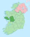
Cill Chiaráin (anglicized as Kilkieran) is a coastal village in the Connemara area of County Galway in Ireland.[1] The R340 passes through Cill Chiaráin.[1]
Cill Chiaráin lies in a Gaeltacht region (Irish-speaking area), and Coláiste Sheosaimh hosts Irish language courses within the village.[2]
Name
[edit]The village is named after Saint Ciarán, "Cill Chiaráin" translates to "Ciarán's church" from Irish.[citation needed] It shares its name with a second Cill Chiaráin in County Kilkenny.[1]
History
[edit]On St Ciarán's feast day, there is a Pattern Day in honour of the saint held in the village. Organised by the local festival committee, Coiste Fhéile Chill Chiaráin, there is a Roman Catholic Mass performed at the well which St Ciarán blessed back in the 6th century.[citation needed]
Amenities
[edit]Cill Chiaráin has a number of facilities and public buildings, including a health centre, a "gastropub" (Tigh Chadhain), local supermarket, a national school, community hall, church and fish factory.[citation needed]
The Arramara Teo seaweed factory is also nearby. The company was previously Irish owned, but has since been bought by a Canadian company.[citation needed]
The village also has a children's playground and the Páirc Peile Chill Chiaráin (artificial pitch) which opened in 2015. The pitch is used by the local GAA team, Carna-Cashel, and the athletics club.[citation needed]
See also
[edit]References
[edit]- ^ a b c "Ordnance Survey Ireland - National Mapping Agency". www.osi.ie. Retrieved 6 May 2019.
- ^ "Colaiste Sheosaimh". www.colaistesheosaimh.com. Retrieved 6 May 2019.


