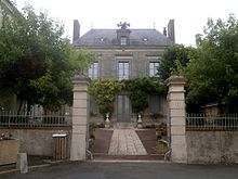
Chemillé-sur-Dême
Chemillé-sur-Dême | |
|---|---|
| Coordinates: 47°39′34″N 0°38′57″E / 47.6594°N 0.6492°E | |
| Country | France |
| Region | Centre-Val de Loire |
| Department | Indre-et-Loire |
| Arrondissement | Chinon |
| Canton | Château-Renault |
| Government | |
| • Mayor (2020–2026) | Éloi Canon[1] |
| Area 1 | 33.54 km2 (12.95 sq mi) |
| Population (2021)[2] | 714 |
| • Density | 21/km2 (55/sq mi) |
| Time zone | UTC+01:00 (CET) |
| • Summer (DST) | UTC+02:00 (CEST) |
| INSEE/Postal code | 37068 /37370 |
| Elevation | 75–164 m (246–538 ft) |
| 1 French Land Register data, which excludes lakes, ponds, glaciers > 1 km2 (0.386 sq mi or 247 acres) and river estuaries. | |

Chemillé-sur-Dême (French pronunciation: [ʃəmije syʁ dɛm]) is a commune in the Indre-et-Loire department in central France.[3]
Geography
[edit]The commune is situated in the Western area, near the borderline of the Sarthe region and Loir-et-Cher in the Indre-et-Loire department in central France. It is bordered by other communes such as, Épeigné-sur-Dême, Villedieu-le-Château, Montroveau, Les Hermites, Marray, Louestault and Neuvy-le-Roi.
The commune is situated approximately 35 – 40 minutes (31 km) from the North of the city, Tours, which is the largest city in the region of Centre-Val de Loire, and the prefecture of the department Indre-et-Loire.
The village includes two notable rivers, La Dême (total length of 32.5 km) as well as La Dêmée (total length of 13.8 km), as well as nine other small rivers including La Rorthe.
The commune is known to have clayey soils in most parts which result in minor cases of shrinkage / swellage, negatively impacting some buildings, and infrastructure.
Population
[edit]| Year | Pop. | ±% p.a. |
|---|---|---|
| 1968 | 800 | — |
| 1975 | 677 | −2.36% |
| 1982 | 644 | −0.71% |
| 1990 | 585 | −1.19% |
| 1999 | 575 | −0.19% |
| 2007 | 659 | +1.72% |
| 2012 | 691 | +0.95% |
| 2017 | 719 | +0.80% |
| Source: INSEE[4] | ||
Mayors
[edit]| Time period | Identity | Political Stance |
|---|---|---|
| March 2001 - March 2008 | Pierre Bonneau | Independant |
| March 2008 – Present | Éloi Canon | Independant |
Personalities linked to the commune
[edit]• Jean Raspail, French writer and explorer born in the commune in 1925, who died in Paris in 2020.
• Louis-Charles Couturier (1817 - 1890), was a Benedictine abbot, born in the village.
See also
[edit]References
[edit]- ^ "Répertoire national des élus: les maires". data.gouv.fr, Plateforme ouverte des données publiques françaises (in French). 2 December 2020.
- ^ "Populations légales 2021" (in French). The National Institute of Statistics and Economic Studies. 28 December 2023.
- ^ INSEE commune file
- ^ Population en historique depuis 1968, INSEE


