Vichy — Charmeil Airport
Appearance
(Redirected from Charmeil Airport)
You can help expand this article with text translated from the corresponding article in French. (August 2012) Click [show] for important translation instructions.
|
Vichy – Charmeil Airport Aéroport de Vichy - Charmeil | |||||||||||
|---|---|---|---|---|---|---|---|---|---|---|---|
| Summary | |||||||||||
| Airport type | Public | ||||||||||
| Operator | Mairie de Vichy | ||||||||||
| Serves | Vichy, France | ||||||||||
| Location | Charmeil | ||||||||||
| Elevation AMSL | 817 ft / 249 m | ||||||||||
| Coordinates | 46°10′18″N 003°24′15″E / 46.17167°N 3.40417°E | ||||||||||
| Map | |||||||||||
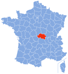
Location of airport in Allier department | |||||||||||
 | |||||||||||
| Runways | |||||||||||
| |||||||||||
Vichy – Charmeil Airport (French: Aéroport de Vichy - Charmeil) (IATA: VHY, ICAO: LFLV) is an airport located in Charmeil, 5 km (3 NM) north-northwest of Vichy,[1] both communes in the Allier department of the Auvergne region in central France.
Facilities
[edit]The airport resides at an elevation of 817 feet (249 m) above mean sea level. It has one runway designated 01/19 with an asphalt surface measuring 2,200 by 45 metres (7,218 ft × 148 ft).[1]
References
[edit]- ^ a b c LFLV – VICHY CHARMEIL. AIP from French Service d'information aéronautique, effective 31 October 2024.


