Causeway Bay North station
Causeway Bay North 銅鑼灣北 | ||||||||||||||||
|---|---|---|---|---|---|---|---|---|---|---|---|---|---|---|---|---|
| Proposed | ||||||||||||||||
 Victoria Park, Hong Kong | ||||||||||||||||
| Chinese name | ||||||||||||||||
| Traditional Chinese | 銅鑼灣北 | |||||||||||||||
| Simplified Chinese | 铜锣湾北 | |||||||||||||||
| ||||||||||||||||
| General information | ||||||||||||||||
| Location | Causeway Bay Wan Chai District, Hong Kong | |||||||||||||||
| Coordinates | 22°16′59.99″N 114°11′9.82″E / 22.2833306°N 114.1860611°E | |||||||||||||||
| Owned by | MTR Corporation | |||||||||||||||
| Operated by | MTR Corporation | |||||||||||||||
| Line(s) | Tseung Kwan O line (proposed) | |||||||||||||||
| Platforms | 2 | |||||||||||||||
| Tracks | 2 | |||||||||||||||
| Construction | ||||||||||||||||
| Structure type | Underground | |||||||||||||||
| Other information | ||||||||||||||||
| Station code | CBN | |||||||||||||||
| Services | ||||||||||||||||
| ||||||||||||||||
| ||||||||||||||||
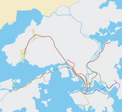
Causeway Bay North or Victoria Park (Chinese: 銅鑼灣北) is a proposed station of the MTR rapid transit network in Hong Kong, situated in the northern part of Causeway Bay to the northwest of Victoria Park on Hong Kong Island. The station is part of the North Island line (NIL) proposal,[1] which includes the extension of the Tseung Kwan O line from its present North Point terminus to Tamar station in Central.
History
[edit]The KCRC also proposed adding Causeway Bay North station as part of the Sha Tin to Central Link (SCL), to be situated between Exhibition Centre and Hung Hom. However, a major drawback was that road traffic would be severely impacted, as this would involve closing Gloucester Road for 5 years. Eventually, the station was eliminated from the SCL plan, after the MTR–KCR merger, and will only be part of the NIL if it is constructed.
In 2013, the name "Causeway Bay North" was mentioned in the Review and Update of the Railway Development Strategy 2000 as an intermediate station on the North Island line, instead of "Victoria Park".[2]
Station Structure
[edit]The terminus of the Tseung Kwan O Line is planned to be extended from North Point Station to Tamar Station, where it will intersect with the extended Tung Chung Line, and this station will be set up halfway between the stations. The underground section may pass through Tsing Fung Street flyover and Victoria Park Road.
See also
[edit]References
[edit]- This article draws some information from the corresponding article in Chinese Wikipedia.
- ^ 沙田至中環線-立法會鐵路事宜小組委員會會議簡報, KCR, 16 February 2004 (in Chinese). Retrieved 17 August 2014.
- ^ "Our Future Railway" (PDF). Hong Kong: MTR. Retrieved 17 August 2014.
External links
[edit]22°16′59.99″N 114°11′9.82″E / 22.2833306°N 114.1860611°E


