Caudebec-lès-Elbeuf
Appearance
(Redirected from Caudebec-les-Elbeuf)
Caudebec-lès-Elbeuf | |
|---|---|
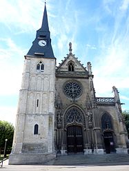
 The church in Caudebec-lès-Elbeuf | |
| Coordinates: 49°16′54″N 1°01′20″E / 49.2817°N 1.0222°E | |
| Country | France |
| Region | Normandy |
| Department | Seine-Maritime |
| Arrondissement | Rouen |
| Canton | Caudebec-lès-Elbeuf |
| Intercommunality | Métropole Rouen Normandie |
| Government | |
| • Mayor (2020–2026) | Laurent Bonnaterre[1] |
Area 1 | 3.68 km2 (1.42 sq mi) |
| Population (2021)[2] | 10,135 |
| • Density | 2,800/km2 (7,100/sq mi) |
| Time zone | UTC+01:00 (CET) |
| • Summer (DST) | UTC+02:00 (CEST) |
| INSEE/Postal code | 76165 /76320 |
| Elevation | 4–75 m (13–246 ft) (avg. 13 m or 43 ft) |
| 1 French Land Register data, which excludes lakes, ponds, glaciers > 1 km2 (0.386 sq mi or 247 acres) and river estuaries. | |

Caudebec-lès-Elbeuf (French pronunciation: [kodbɛk lɛ.z‿ɛlbœf], literally Caudebec near Elbeuf) is a commune in the Seine-Maritime department in the Normandy region in northern France.
Geography
[edit]A residential and light industrial town situated by the banks of the river Seine, some 13 miles (21 km) south of Rouen, at the junction of the D919 and the D921 roads.
It used to be the site of the Caudebec bore, or tidal wave, which several times a year rushed up the river from the sea. However the tidal estuary was changed to improve shipping access and the bore ceased to function.
Heraldry
[edit] |
The arms of Caudebec-lès-Elbeuf are blazoned: Gules, a sickle reversed and sprig of mistletoe in saltire between (a lance inverted and a throwing axe [francisca] in saltire surmounting a gaulish shield bendwise topped with a winged gaulish helmet contourny) and a dolmen Or charged with the letters ESUS sable impaled with Azure, a she-wolf nursing Romulus and Remus, standing on a pedestal Or charged with the inscription ROMA sable, and in chief a round shield surmounted by (i.e. overall over the shield), a sword palewise, a fasces bendwise, a Aquila bendwise sinister and a trumpet fesswise Or. (An Aquila is a Roman legion's eagle standard; the trumpet is a Roman trumpet 'tuba').
|
Population
[edit]Graphs are unavailable due to technical issues. There is more info on Phabricator and on MediaWiki.org. |
| Year | Pop. | ±% p.a. |
|---|---|---|
| 1968 | 9,595 | — |
| 1975 | 9,469 | −0.19% |
| 1982 | 8,963 | −0.78% |
| 1990 | 9,902 | +1.25% |
| 1999 | 9,904 | +0.00% |
| 2007 | 9,640 | −0.34% |
| 2012 | 10,030 | +0.80% |
| 2017 | 10,335 | +0.60% |
| Source: INSEE[3] | ||
Places of interest
[edit]- The church of Notre-Dame, dating from the twelfth century.
- A twentieth-century château.
Twin towns
[edit] Dereham, England
 Vigarano Mainarda, Italy
 Bad Dürrenberg, Germany
 Prague - Libuš, Czech Republic[4]
See also
[edit]References
[edit]- ^ "Répertoire national des élus: les maires". data.gouv.fr, Plateforme ouverte des données publiques françaises (in French). 2 December 2020.
- ^ "Populations légales 2021" (in French). The National Institute of Statistics and Economic Studies. 28 December 2023.
- ^ Population en historique depuis 1968, INSEE
- ^ Twin towns - in French Archived 2012-12-17 at the Wayback Machine
External links
[edit]Wikimedia Commons has media related to Caudebec-lès-Elbeuf.
- Official town website (in French)


