Brookfield, Preston
| Brookfield | |
|---|---|
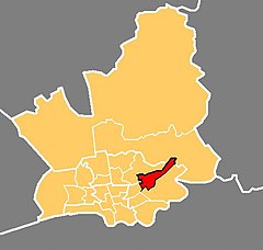
 Location in the City of Preston district | |
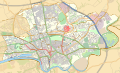
Location within Lancashire | |
| Population | 7,301 (2011) |
| District | |
| Ceremonial county | |
| Region | |
| Country | England |
| Sovereign state | United Kingdom |
| UK Parliament |
|
| Councillors |
|
Brookfield is an electoral ward of the city of Preston, in Lancashire, England. It is located north-east of the city centre, in the suburb of Ribbleton. At the 2001 census the ward had a population of 7,625,[1] reducing to 7,301 at the 2011 Census.[2] The area is represented on the city council by three Labour councillors. The area forms part of the Preston East division of Lancashire County Council, represented by one Labour councillor.
The area is mainly residential, and the majority of homes are privately owned although there is also a large council estate. The ward also contains a modern business park, which includes the head office of Booths, a regional chain of supermarkets. This is close to junction 31A on the M6 motorway.
Current members
[edit]| Election | Member | Party | |
|---|---|---|---|
| 2015 Preston City Council election | Nerys Eaves | Labour Party | |
| 2013 Preston City Council election | Philip Corker | Labour Party | |
| 2014 Preston City Council election | John Browne | Labour Party | |
Transport
[edit]The M6 motorway runs through the area, but until recently there was no junction nearby. Junction 31A has now been built, but there is no connection to or from the Lancaster direction.[4] Ribbleton railway station was near the Ribbleton ward boundary but the line has now closed. Bus services are provided by Preston Bus.
References
[edit]- ^ "Archived copy" (PDF). Archived from the original (PDF) on 29 October 2007. Retrieved 7 November 2007.
{{cite web}}: CS1 maint: archived copy as title (link) - ^ UK Census (2011). "Local Area Report – Brookfield 2011 Census Ward (1237324273)". Nomis. Office for National Statistics. Retrieved 10 March 2018.
- ^ Preston City Council
- ^ How to Find Us[permanent dead link]
External links
[edit]


