Boukoumbé
Boukoumbé | |
|---|---|
 | |
| Coordinates: 10°11′N 1°6′E / 10.183°N 1.100°E | |
| Country | |
| Department | Atakora Department |
| Area | |
• Total | 1,036 km2 (400 sq mi) |
| Elevation | 223 m (732 ft) |
| Population (2013 census) | |
• Total | 83,147 |
| Time zone | UTC+1 (WAT) |
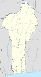
Boukoumbé [bu.kum.be] or Boukombé [bu.kɔ̃.be] is a town, arrondissement and commune in north western Benin on the border with Togo. It is known for its market, its whipping ceremony and for its tradition of pipe making. Mount Kousso-Kovangou, the highest point in Benin, lies nearby.
The commune covers an area of 1036 square kilometres and as of 2002 had a population of 60,568 people.[1][2][3]
Geography
[edit]The town of Boukoumbé is located 582 kilometres from Cotonou and lies on the border with Togo in the west of the country.[2] Communally it is bounded to the north by Cobly and Tanguiéta, south by Copargo, west by Togo and east by Toucountouna, Kouandé and Natitingou.[2]
Administrative divisions
[edit]Boukoumbé is subdivided into 7 arrondissements; Boukoumbè, Dipoli, Korontière, Kossoucoingou, Manta, Natta and Tabota. They contain 55 villages and 16 urban districts.[2]
Economy
[edit]Most of the population are engaged in agricultural activities followed by trade, transportation and handicrafts. The main crops grown are maize, cotton, cowpeas, peanuts, okra, cassava and tomatoes.[2]
References
[edit]- ^ "The World Gazetteer". Archived from the original on 2013-01-05. Retrieved 2007-02-20.
- ^ a b c d e "Boukoumbe". Atlas Monographique des Communes du Benin. Archived from the original on February 26, 2009. Retrieved January 5, 2010.
- ^ "Communes of Benin". Statoids. Retrieved January 5, 2010.
External links
[edit]10°11′N 1°06′E / 10.183°N 1.100°E


