Bir Gandus
Appearance
(Redirected from Anzarane)
This article needs additional citations for verification. (February 2013) |
Bir Gandus
بئر كندوز Bir Ganduz | |
|---|---|
| Coordinates: 21°37′N 16°28′W / 21.617°N 16.467°W | |
| Territory | Western Sahara |
| Claimed by | |
| Controlled and occupied by | Morocco |
| Area | |
| • Total | 2,186.44 km2 (844.193 sq mi) |
| Population (2014)[1] | |
| • Total | 4,625 |
| • Density | 2.1/km2 (5.5/sq mi) |
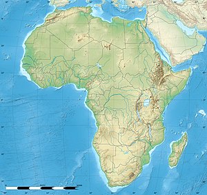
Bir Gandus or Bir Gandouz (Arabic: بئر كندوز Biʾr Kandūz, Moroccan Arabic: بير گندوز, Berber: Bir Genduz, Spanish: Bir Ganduz) is a village in Western Sahara, currently occupied by Morocco.[2][3] As a claimed rural commune of Morocco it serves as the headquarters of Morocco's Aousserd Province and recorded a population of 4625 in the 2014 Moroccan census.[1] It holds a Moroccan military post.[4] Although sometimes called so, it is not a border post. The border post to Mauritania is to the west on the RN1 at Guerguerat although the stamp given there bore the name of Bir Gandus.[5]
In February 2023, the Royal Moroccan Football Federation announced the construction of two football fields in Bir Gandouz and Guerguerat.[6][7]
References
[edit]- ^ a b "Population légale des régions, provinces, préfectures, municipalités, arrondissements et communes du royaume d'après les résultats du RGPH 2014" (in Arabic and French). High Commission for Planning, Morocco. 8 April 2015. Retrieved 29 September 2017.
- ^ "A/RES/35/19 - E - A/RES/35/19". Question of Western Sahara. p. 214. Retrieved 8 Apr 2021.
- ^ Christian Walter; Antje von Ungern-Sternberg; Kavus Abushov (5 June 2014). Self-Determination and Secession in International Law. OUP Oxford. p. 264. ISBN 978-0-19-100692-0.
- ^ "Bir Gandus, Western Sahara Page", Falling Rain Genomics
- ^ "transafrika.org" (in German). Retrieved 4 January 2019.
- ^ "Infrastructures : Le lancement des travaux d'aménagement des terrains de Bir Gandouz et Guergearat". FRMF (in French). Retrieved 2023-05-10.
- ^ "La FRMF va aménager des terrains à Guergarate et Bir Gandouz". L'Economiste (in French). 2023-02-23. Retrieved 2023-05-10.


