Alatyr (river)
Appearance
(Redirected from Alatyr River)
| Alatyr | |
|---|---|
 Alatyr River, view from the railway bridge at Alatyr train station | |
| Native name | Алатырь (Russian) |
| Location | |
| Country | Russia |
| Physical characteristics | |
| Source | |
| • coordinates | 54°47′31″N 45°06′50″E / 54.792°N 45.114°E |
| Mouth | Sura |
• coordinates | 54°52′10″N 46°35′55″E / 54.8694°N 46.5985°E |
| Length | 296 km (184 mi) |
| Basin size | 11,200 km2 (4,300 sq mi) |
| Basin features | |
| Progression | Sura→ Volga→ Caspian Sea |
| Tributaries | |
| • right | Insar |
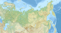
The Alatyr (Russian: Алатырь, IPA: [ɐˈɫatɨrʲ]) is a river in Mordovia, Russia, and it is the left tributary of the river Sura.[1] It is 296 kilometres (184 mi) long, and has a drainage basin of 11,200 square kilometres (4,300 sq mi).[2] The Alatyr freezes up in November and stays icebound until April. The towns of Ardatov and Alatyr (Erzya: Ратор, Rator), are located on the Alatyr River.[3]
References
[edit]- ^ Алатырь (река), Great Soviet Encyclopedia
- ^ «Река АЛАТЫРЬ», Russian State Water Registry
- ^ Evtuhov, Catherine (November 2011). Portrait of a Russian Province: Economy, Society, and Civilization in Nineteenth-century Nizhnii Novgorod. University of Pittsburgh Pre. ISBN 9780822977452.

