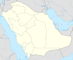
Al Masani (Riyadh)
Al-Masaniʽ
حي المصانع | |
|---|---|
 Souq Haraj in al-Masani, 2022 | |
| Coordinates: 24°34′34″N 46°44′2″E / 24.57611°N 46.73389°E | |
| Country | Saudi Arabia |
| City | Riyadh |
| Government | |
| • Body | Baladiyah Al Shifa |
| Language | |
| • Official | Arabic |
Al-Masaniʽ (Arabic: المصانع, romanized: al-maṣāniʿ, lit. 'industrial plants') is a historic neighborhood and a former town in southern Riyadh, Saudi Arabia, situated south of Manfuhah in the sub-municipality of al-Shifa.[1] The neighborhood traces its origins to an ancient agricultural village that served as a confluence of Wadi Hanifa and Wadi al-Batʼha and was known for its cultivation of palm groves in al-Yamama during pre-Islamic Arabia.[2][3] It was also mentioned in Yaqut al-Hamawi's 13th century work Kitāb Mu'jam al-Buldān (transl. Dictionary of Countries).[4] It was incorporated into the burgeoning metropolis of Riyadh during the city's multiple phases of urbanization and expansion in the 1950s and 1970s.
Masani was also a site of conflict in 1837 when Imam Faisal's forces clashed with the Ottomans and the forces of its Riyadh-based vassal emirate during the former's attempt to regain control of the region.[5]
References
[edit]- ^ "حي المصانع بالرياض يعج بالعمالة السائبة والحيوانات والطيور النافقة زرائب وأحواش الحيوانات والمواشي تحتاج لرقابة وعناية ونظام". www.al-jazirah.com. Retrieved 2023-01-04.
- ^ NA, NA (2015-12-22). Saudi Arabia in the Nineteenth Century. Springer. ISBN 978-1-349-81723-8.
- ^ "المصانع.. حينما تتحول الذكريات إلى مصانع عشوائية". www.alriyadh.com (in Arabic). 16 December 2011. Retrieved 4 January 2023.
- ^ . St. J. B. Philby The Geographical Journal, Vol. 55, No. 3 (Mar., 1920), pp. 161-185 [1] Published by: Blackwell Publishing on behalf of The Royal Geographical Society (with the Institute of British Geographers) Archived 2016-03-07 at the Wayback Machine
- ^ NA, NA (2015-12-22). Saudi Arabia in the Nineteenth Century. Springer. ISBN 978-1-349-81723-8.


